Accessing the A.T.
Accessibility on the Appalachian Trail
The Appalachian Trail (A.T.) winds through some of the most diverse and variable terrain in the U.S., from rugged wilderness to rolling farmland to paved roads through vibrant A.T. Communities. With some planning, people of all abilities and experience levels can experience parts of the A.T. Here are some resources on accessing the A.T. for people with limited mobility and/or mobility disabilities, and those who have service dogs.
Wheelchair Accessibility
While most wheeled devices (such as bicycles and carts) are not allowed on the A.T., wheelchairs that meet the American with Disabilities Act (ADA) definition are welcome along the Appalachian Trail anywhere that foot traffic is allowed. The ADA defines wheelchairs as:
“a manual or power-drive device designed primarily for use by an individual with a mobility disability for the main purpose of indoor or both indoor and outdoor locomotion.”
In federally designated wilderness areas, the definition of a wheelchair is slightly different:
“a device designed solely for use by a mobility impaired person for locomotion, that is suitable for use in an indoor pedestrian area.”
It is important to note that much of the Trail may not be suitable for wheelchair use due to terrain, even for those chairs that meet the above definitions. Most of the Trail traverses rocky, uneven terrain via a narrow footpath and many of the footbridges and bog bridges on the A.T. are not traversable in a wheelchair or without assistance. The Trail and terrain at overnight sites may also not be accessible without assistance even if certain structures, like newer privies and shelters, are.
Osborne Farm by Laurie Potteiger
If you are ever unsure if a wheelchair or mobility device is suitable for a particular section of the Trail, contact us or the local land management agency.
There are a few sections of the Appalachian Trail that were built to ADA/the Architectural Barriers Act (ABA) standards specifically so they may be accessed by a wheelchair.
See below for a list of accessible sections of the A.T. from North to South.
Sections of the A.T. Accessible by Wheelchair
Thundering Falls, Killington, Vermont
This piece of the A.T. includes 700 feet of elevated boardwalk, as well as approximately 500 feet of gravel-surfaced tread which climbs approximately 19 feet via switchbacks to the base of Thundering Falls, a 100-foot waterfall, the sixth largest in the state of Vermont. This Trail segment was opened for public use in 2007.
More detailed Trail info about Thundering Falls coming soon! Photo by Ilana Copel.
Falls Village, Connecticut
 This was the first A.T. project, undertaken by ATC and the Connecticut Chapter of the Appalachian Mountain Club in 2000, to provide wheelchair access along a portion of the A.T. The project involved the construction of an approximately 1.1-mile loop trail, a portion of which serves as the Appalachian Trail, along the banks of the Housatonic River.
Click here for more detailed Trail info about Falls Village. Photo by Kevin Prendergast near Falls Village.
Bear Mountain State Park, New York
 The portion designed for wheelchair use is approximately 0.5 mile (2,465 feet) in length, extending from an existing parking area accessed by a park road at the top of the mountain through relatively level terrain with shallow soils and numerous rock outcroppings. Part of this route also coincides with the very first A.T. section to be opened. There is also a short piece of the A.T. that may be suitable for wheelchairs in the vicinity of the Bear Mountain Zoo.
More detailed Trail info about Bear Mountain coming soon! Photo by Kevin “Terrapin” Bodine.
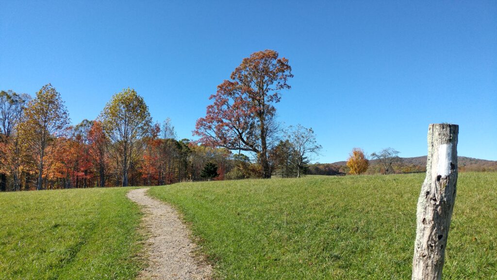
Osborne Farm, Shady Valley, Tennessee
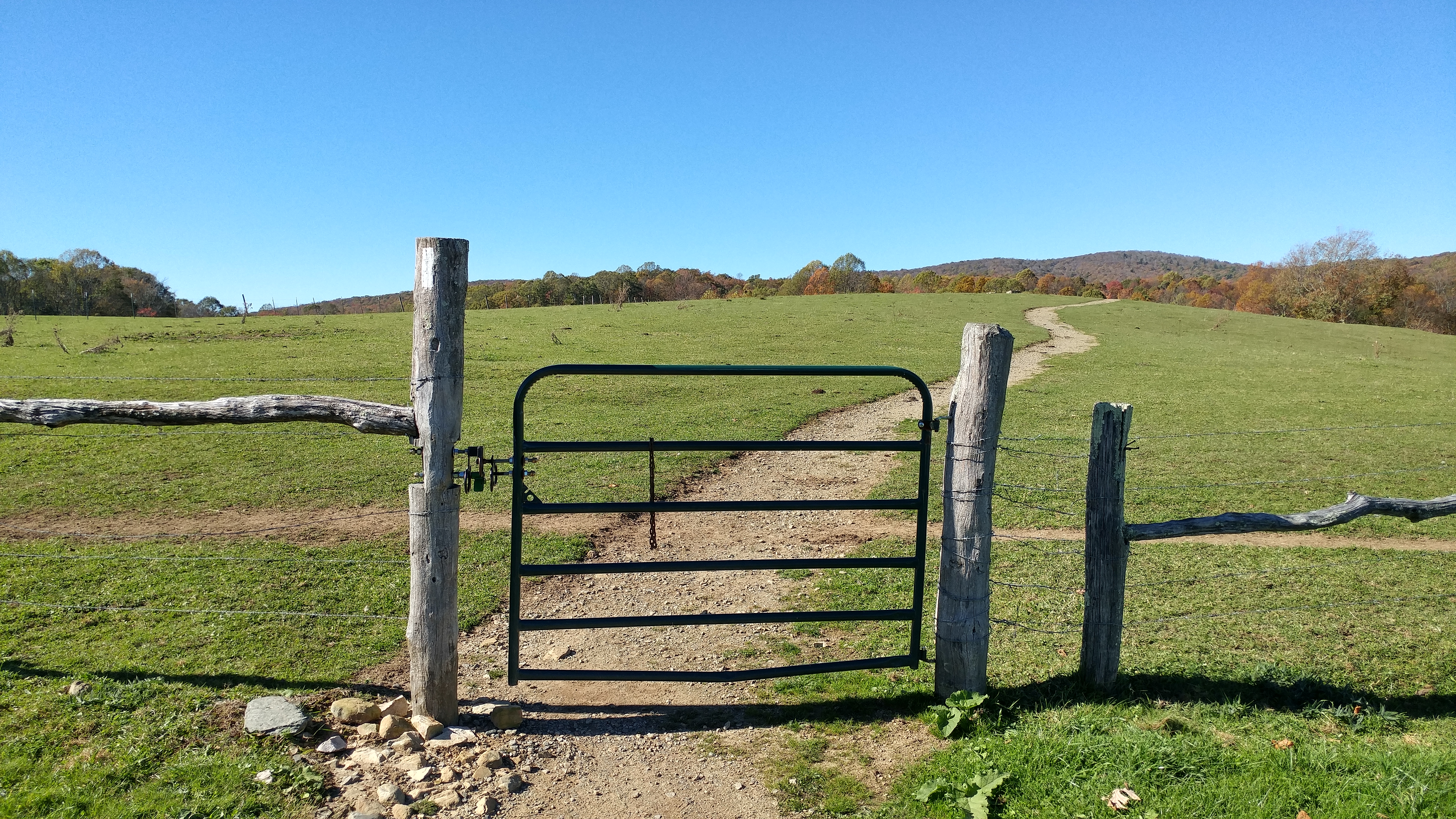
This 0.5 mile section is situated at higher elevations (approximately 3,500 feet) in an open pasture. The Trail gradually rises from the parking area to the height of land, terminating at a bench and affording sweeping views of the surrounding mountains, including distant views of Mount Rogers in the neighboring Virginia highlands. This portion of the A.T. was built to accommodate mobility impairments and was opened for public use in 2006.
Please note: grazing cows may be encountered, and occasionally block the Trail.
More detailed Trail info abou Osborne Farm coming soon! Photo by Laurie Potteiger.
Other Sections to Visit
There are several other sections of the Trail that were not built specifically to ADA/ABA standards but may still be suitable for wheelchair use and/or for hikers with limited mobility.
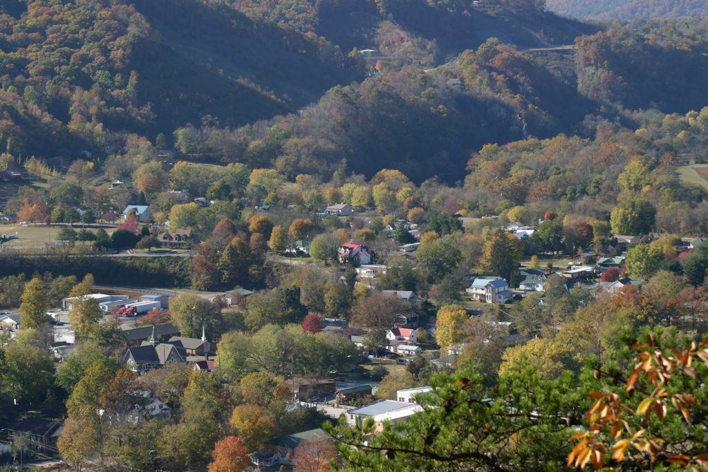
The town of Hot Springs, NC
A.T. Communities: There are several sections of the Trail that coincide with paved roads and sidewalks through scenic A.T. Communities. One of the longest stretches of the A.T. on paved roads is a 2-mile section through the A.T. Communities of Norwich, Vermont and Hanover, New Hampshire. In another A.T. Community, Hot Springs, North Carolina, the A.T. follows the main street through town for just under a mile.
Fontana Dam: The Trail traverses Fontana Dam in North Carolina, just before it climbs into the Great Smoky Mountains National Park. At 480 feet, Fontana Dam is the tallest dam in the eastern U.S. The A.T. crosses the top of the dam via a paved sidewalk.
Kuwohi: The tallest point on the entire A.T., Kuwohi, formerly called Clingmans Dome sits at 6,643 feet and is accessible via a 0.5-mile trail in Great Smoky Mountains National Park. While the trail up to Kuwohi is too steep to be wheelchair accessible, it is a wide, paved path with periodic benches.
Virginia Creeper Trail: The A.T. coincides with the Virginia Creeper Trail in southwest Virginia for a very short distance but used to follow it for several miles. The Virginia Creeper Trail goes through the small A.T. Community of Damascus, Virginia, dubbed “the friendliest town on the A.T.” While you might not be able to go far on the A.T. itself, you could still soak up the A.T. experience and spend some time on the Virginia Creeper Trail, knowing that a portion of it was a historic route of the A.T.
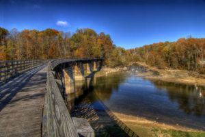
A bridge along the Virginia Creeper Trail by Jason Barnette
Pochuck Creek: The largest A.T. construction project to date that may be traversed by wheelchair, this project involved the construction of more than one mile (6,000 feet) of elevated boardwalk over the largest wetland area along the entire length of the Appalachian Trail, as well as the construction of a unique 144-foot suspension bridge over the main channel of Pochuck Creek.
This section is not listed in the section above because access to the boardwalk does not meet ABA standards, including a non-standard transition from the pavement to the gravel. There is also no roadside parking reserved for people with disabilities, so getting to the Trail may require traveling along the road. There is also a short section before reaching the suspension bridge where the boardwalk ends and the footpath follows dirt tread with many roots.
C&O Canal Towpath: The A.T. coincides with the C&O Canal Towpath in Maryland for just under 3 miles, where bicycles and non-motorized, wheeled vehicles are allowed. The Towpath is a relatively flat trail following the Potomac River for 184 miles from Washington, DC to Cumberland, Maryland. Along its length are hiker/biker campsites.
Mt. Washington: One of the most iconic summits on the Trail is accessible via car. Mt. Washington, the highest peak in New Hampshire’s Presidential Range at 6,288 feet, can be accessed via the Mt. Washington Auto Road and has several amenities at the top, including a food court, bathrooms, and the Mt. Washington Weather Observatory.
There are many other sections of varying lengths that utilize Universal Design principles, which enhance usability for everyone. Contact us for more information.

Amenities Along the Trail
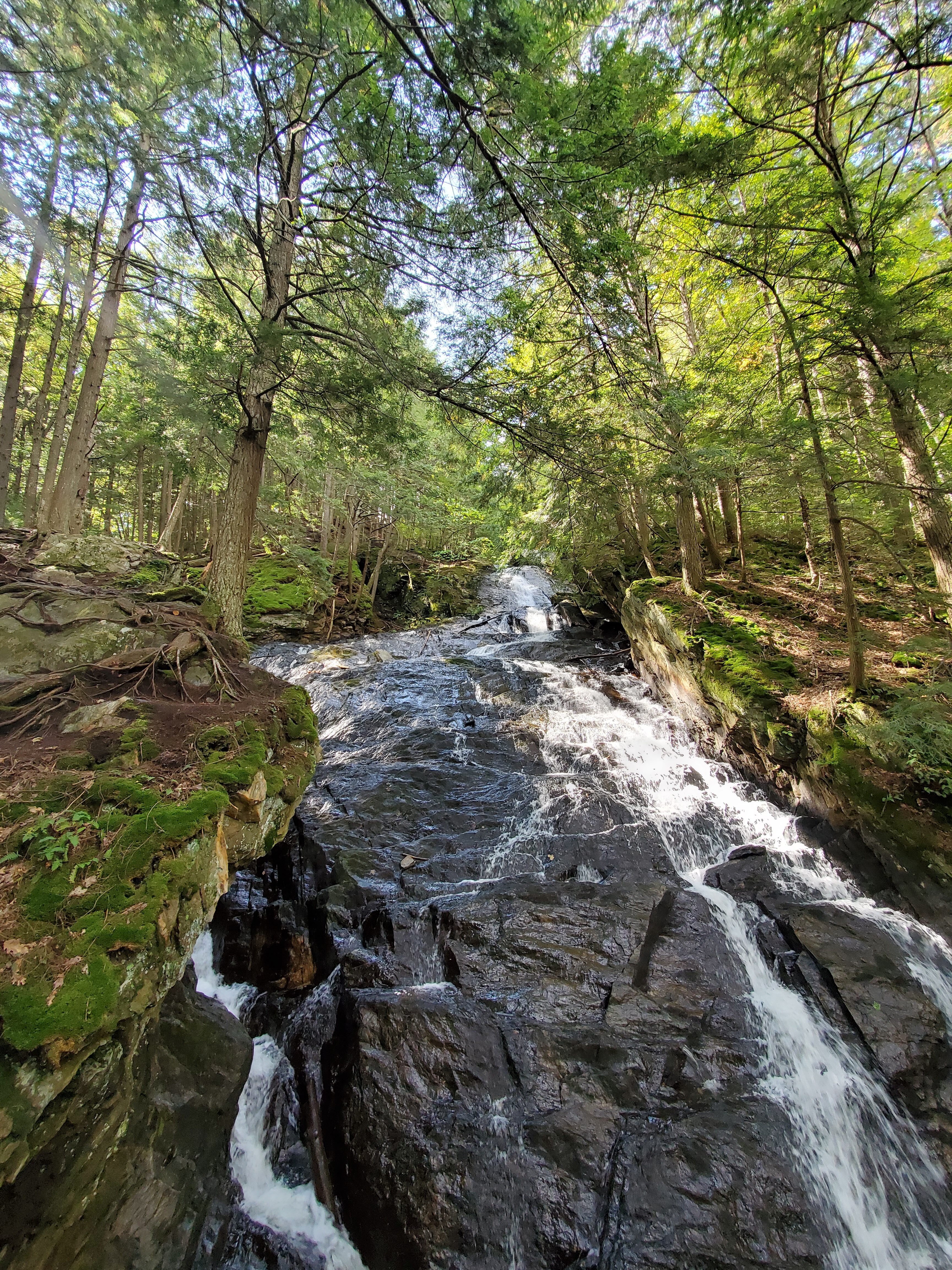
There are limited amenities along the Trail and overnight sites can generously be described as “rustic.” Most shelters and designated campsites have a reliable water source and a privy (or outhouse, like the Moose Mountain privy pictured to the right. Photo by Ilana Copel). Unless posted otherwise, water sources along the Trail are not potable and should be filtered and/or treated before being used for cooking, drinking, washing, and cleaning any medical equipment. Learn more about water on the Trail here.
Since the inception of accessibility guidelines for outdoor recreation areas, all new A.T. structures have been built to accessible standards. Keep in mind that the layout of overnight sites is often not accessible, though. Trails from camping areas to water and the privy can be narrow and not graded, cooking areas may not feature accessible seating, and tenting areas may not be designed to accessible standards.
Parking areas along the A.T. vary from large, paved lots to small dirt pull-offs. While public transportation to and from the Trail is limited, there are several sections of the Trail accessible via public transportation and there is an extensive shuttle network along the A.T. Visit our Transportation Options page for more information.
You can use our Interactive Map to view photos of most parking areas and shelters to help plan your trip.

Inn-to-Inn Hiking
In both Shenandoah National Park and the White Mountains of New Hampshire, hikers can create an itinerary where they carry only a day pack and then sleep in an inn or lodge each night (like Lonesome Lake Hut, pictured to the left. Photo by Laurie Potteiger). These itineraries can be helpful for visitors who are concerned about carrying the weight of an overnight backpack.
Learn more through Go Shenandoah or the Appalachian Mountain Club.
With some logistical planning and research, you can also hike inn-to-inn in several other sections of the A.T. by “slackpacking.” Slackpacking (hiking sections without a full overnight pack) has become increasingly popular in recent years, and many shuttlers, hostel owners, and B&Bs along the A.T. offer this support service. Visit our Transportation Options page for information on shuttles or check with your lodging provider.

Service Dogs
Each year service dogs assist their handlers in visiting the A.T. and experiencing the Trail (Like Warrior Hiker Jessie with his service dog, Cooper, pictured right). Under the ADA, service animals are defined as “dogs that are individually trained to do work or perform tasks for people with disabilities” and are welcome anywhere along the A.T. that visitors are allowed to go.
Like with any dog on the Trail, service dog handlers should be sure to practice Leave No Trace with their dog. This includes packing out or burying the dog’s waste, keeping the dog on a leash (unless the leash interferes with the service dog’s performance of its trained tasks), and sleeping in a tent rather than a shelter. Learn more about hiking with dogs here.
If you would like more information about bringing your service dog to the A.T., contact us or the local land management agency.
More Information and Resources
If you have questions, would like more information, or have feedback about this page, please contact us via our website or by calling 304-535-6331.
- Use our Interactive Map to plan any trip. Most of the parking areas and shelters have photos attached to their waypoint so you can view those areas ahead of time.
- Check out the book Best of the A.T.: Day Hikes for more information about day hiking and slackpacking.
- Ask about our affinity lists, which are lists of hikers with different experiences and identities who are willing to talk with prospective hikers about their experience on the A.T. Contact us for an affinity list of hikers who completed the A.T. by day hiking and/or an affinity list of people who hiked the A.T. with an injury and/or disability.
- Visit the accessibility page of the National Park Service website for information about accessibility in national parks and on National Park Service land.
- Visit the accessibility page of the U.S. Forest Service website for information about accessibility in national forests and on U.S. Forest Service land.
- Learn more about the wealth of rail trails throughout the country, many of which have a mild or flat grade and are wide, gravel, or dirt paths. The American Trails website and the American Hiking Society are great resources for finding out more.
Coming soon: a list of organizations working to assist people with disabilities in accessing the outdoors. Have a suggestion? Please let us know!