Trailhead parking areas along the Appalachian Trail (A.T.) vary widely. Many are dirt or gravel and may be unmarked. Others are paved. Some feature trailhead kiosks with information about the local area but many do not. Restroom facilities are rare except at some state park trailheads. Most trailheads close to population centers fill up early in the day on weekends so getting an early start and having an alternate location in mind is always a good plan. Plan ahead and prepare!
Safety Tips Before You Leave Home
Most trailhead parking areas are relatively safe, but vandalism or theft is a possibility at any remote trailhead. Before you leave home:
- Leave valuables at home. If you must take something of value, stow it in the trunk before you reach the trailhead.
- Check recent vandalism reports and info about closed parking lots. Information can be obtained by contacting the local Trail Clubs or police. Visit our Trail Updates page for locations where vandalism and lot closures have recently been reported to ATC.
- Research parking at a local business instead if you’ll be on the Trail for more than a day or two. Local businesses near the Trail may present good parking alternatives, just be sure to request permission ahead of time. Check out an updated guide like FarOut or the Thru-Hiker’s Companion in our Trail Store to find businesses close to the A.T.
- Know where overnight and long-term parking is and is not allowed. Overnight parking is allowed at most A.T. trailheads, but check the signs when you arrive.
McAfee Knob Trailhead Shuttle Service
Roanoke County has partnered with Ride Source to provide a shuttle service to the McAfee Knob Appalachian Trail trailhead in Virginia, providing easier parking options for your visit and easing unsafe traffic and parking conditions at the trailhead parking lot.
Learn More
Roanoke County, VA
How to Find Trailheads & Where to Park


Tips at the trailhead before you hit the A.T.
- Make sure you have your car keys.
- Turn off your headlights and lock your vehicle, stowing valuables in the trunk if you brought any (preferably do this before arriving at the trailhead).
- Check the trailhead information kiosk for notices and local information that can enhance your hike or alert you to unusual circumstances, special regulations, or closures.
- Make sure you’re headed in the right direction. This is where your map and compass come in handy. Keep in mind “Trail north” is sometimes east (or another direction).
- Put things you might need in the first hour of the hike in a pocket. That might be tissues, wipes, a resealable bag, or your map and compass.
- Put your cellphone in airplane mode. This will prevent your phone from roaming and save battery life, as well as prevent unwelcome rings in the backcountry that may disturb others.
- Note what time you left the car so you can gauge your progress.
Shuttle Services
Private shuttle services can be found all along the Appalachian Trail. Advance arrangements are recommended (1-2 weeks or more in advance is best, especially for longer shuttles).
Ride-sharing services such as Uber or Lyft and sometimes taxis may be available where the A.T. passes near populated areas, such as parts of the mid-Atlantic (northern Virginia through New York) or close to major cities like Roanoke, Virginia. However, in remote areas, typically no such services exist.
Cell service is often unreliable or unavailable at trailheads. Research options and make plans in advance.
The following links are provided as an information service for A.T. hikers and do not constitute an endorsement by the Appalachian Trail Conservancy (ATC) of the dependability or safety of the service providers in these listings. Be aware that those providing listings do not necessarily conduct background checks of shuttle drivers on their listing, nor verify that they hold appropriate licenses, permits, or insurance.
WhiteBlaze.net – Large A.T. discussion forum with articles and trailwide shuttle providers listing.
TheTrek.co – Extensive community-generated content, with blogs, advice, and a listing of shuttles buses, and taxis.
Georgia: Georgia A.T. Club – The maintaining Club for the A.T. in Georgia, with info on directions, shuttles, and parking and other info about the Georgia A.T. for hikers, including how to get to Springer/the Approach Trail from Atlanta.
North Carolina/Tennessee: Great Smoky Mountains National Park – The park has a list of shuttle drivers authorized to operate within the park. Be aware that all overnight hikers must have a backcountry permit in the park that must be acquired in advance.
Central Virginia: Roanoke A.T. Club – The maintaining Club that covers more than 100 miles of the A.T. in central Virginia has a shuttle drivers listing and other info on hiking in their section, including the Virginia Triple Crown.
VA Triple Crown & McAfee Knob: Roanoke County provides a shuttle service to increase access to and reduce vehicle congestion at McAfee Knob and the Virginia Triple Crown parking areas. The McAfee Shuttle brings hikers to/from the I-80 Park & Ride to the A.T. at VA Route 311. Reservations are encouraged. There is a $5 fee each way.
Delaware Water Gap National Recreation Area: The National Park Service and Monroe County Transit Authority provides a local shuttle serving the recreation area, including a Hiker Shuttle that stops near where the A.T. follows Delaware Avenue and Main Street on the west side of the Delaware River. The Hiker Shuttle is free.
New Hampshire: The Appalachian Mountain Club (AMC) provides a hiker shuttle in the White Mountains, primarily serving trailheads to access their backcountry huts system. The shuttle has stops on the A.T. in Franconia Notch, Crawford Notch, and Pinkham Notch, and has stops in Gorham. The shuttle is $20 one way for AMC members, $24 for non-members.
Franconia Notch: Franconia Notch State Park and Cannon Mountain Ski Area provide a shuttle to increase access to and reduce vehicle congestion at the highly popular Franconia Notch State Park and Franconia Notch trailheads. The shuttle drops hikers off at the Old Bridle Path, a few miles north of the A.T. crossing along I-93. The shuttle is $5 one way.
Official Maps and Guidebooks show trailhead parking areas, road crossings, and all major trail features. ATC maps are available from Mountaineers Press for Georgia through Central Virginia and New Jersey through Maine; maps for Shenandoah National Park, northern Virginia, Maryland, and Pennsylvania are available from the ATC Trail Store.
The A.T. Thru-Hikers’ Companion, available from the ATC’s Ultimate Trail Store, lists all major trail features from Georgia to Maine including all road crossings; shuttle service providers are also listed.
Outfitters and hostels along the A.T. may be able to provide information on local shuttlers. Outfitters and hostels with an A.T. Community Supporter designation can be found in A.T. Communities; a trail-wide listing on WhiteBlaze.net can be found here.
Buses, Trains, and Airports
Some towns along the Appalachian Trail (A.T.) have local public transit systems to get you from town to town, or from town to the A.T. In addition, you can find bus and train station locations for national transit companies. There are also some regional airports that service larger hubs within a 30-minute drive of the A.T., particularly in the mid-Atlantic and northeast.
Airport with an asterisk (*) indicate a major international hub.
MegaBus – (877) GO2-MEGA; (877) 462-6342; us.megabus.com; Service between some mid-size towns along the A.T. and large cities of East Coast and elsewhere.
Greyhound Bus Lines – (800) 231-2222 www.greyhound.com
Trailways Bus Lines – (800) 343-9999 www.trailways.com
Amtrak – (800) USA-RAIL www.amtrak.com
Amtrak – Crescent Train stops in Atlanta, 68 miles from Amicalola Falls State Park (where a visitor center and the Approach Trail are located). Atlanta is 99 miles from Springer Mountain, the southern terminus of the A.T. Private shuttle services, often quite knowledgeable about the A.T., are available to get you from the bus terminal to AFSP or Springer Mountain (see listings at left). The Gainesville station is 36 miles from AFSP; taxis are usually available here, but there are fewer private shuttle options. Taxis are generally not a recommended option for getting to Springer Mountain (which requires travel over rough and remote Forest Service roads that may be impassible to passenger cars in winter and spring).
Atlanta Airport* – The Hartsfield International Airport is a major airline hub and the headquarters for Delta airlines.
Options listed from south to north:
Macon County Transit (Franklin) – Bus route around town Monday-Friday and seasonally (usu. late Feb. through May) to Winding Stair Gap and Rock Gap, $3.00. Other locations in the county by advance arrangement. macontransit.com, (828) 349-2222.
Gatlinburg Trolley – Free daily trolley service in downtown Gatlinburg, 15 miles west of the A.T. at Newfound Gap in Great Smoky Mountains National Park. www.gatlinburg.com/trolley
McGhee Tyson Airport – A regional airport in Knoxville, TN. About an hour and half drive west of the A.T. at Newfound Gap. flyknoxville.com
Asheville Regional Airport – About an hour southeast of Hot Springs or 45 minutes south of the A.T. at Sams Gap/I-26. Daily flights to major U.S. hubs including Atlanta, New York, Washington D.C., and Chicago. flyavl.com
Tri-Cities Airport – Located in Bristol, TN, about 50 minutes west of the A.T. at Watauga Lake or 50 minutes southwest of Damascus, VA. flytri.com
Tri-Cities Airport – Located in Bristol, TN, about 50 minutes west of the A.T. at Watauga Lake or 50 minutes southwest of Damascus, VA. flytri.com
Mountain Lynx Transit (Marion) – Service between Marion and the A.T. at Mt. Rogers National Recreation Area Headquarters (NRA HQ) Monday through Friday by advance arrangement only for. Call (276) 782-9300 in advance to arrange pick-up; 24 hours in advance recommended. district-three.org.
Bluefield, WV Greyhound Bus Station – Located 12 miles north of US 52.
Wytheville Greyhound Bus Station – Located 16 miles south of the A.T. crossing at US 52 (Between Bland and Bastian).
Roanoke Greyhound Bus Station – Located about 10 miles from the A.T. crossing at U.S. 220 near Daleville and 17 miles from the A.T. crossing at Va.311 near Catawba.
Roanoke Regional Airport – Located about 11 miles from the A.T. crossing at U.S. 220 near Daleville. Flights to major airports, including Atlanta, New York, and Chicago. flyroa.com
McAfee Knob Trail Shuttle – Runs every Friday, Saturday, and Sunday from March to November between the I-81 Exit 140 Park & Ride and the A.T. trailhead parking lot on Route 311 mcafeeshuttle.com
Smart Way Commuter Bus – Operates between Roanoke and Blacksburg, VA; (540) 982-6622 (800) 388-7005 info@valleymetro.com www.smartwaybus.com
Maury Express – Bus services in Buena Vista and Lexington.
Waynesboro Tourism Office – For long-term A.T. hiker parking details and information about shuttles to and from Rockfish Gap, hikers can call the Tourism Office at (540) 942-6512 (weekdays) or The Rockfish Gap Tourist Information Center at (540) 943-5187 (7 days/week).
Staunton Virginia Breeze stop – Bus stop 15 miles west of Rockfish Gap at southern entrance of Shenandoah National Park. Virginia Breeze bus line offers service from Union Station in Washington, DC to points south including Dulles Airport, Front Royal, Staunton, Lexington, and Blacksburg. Virginia Breeze
Charlottesville-Albermarle Airport – Charlottesville, Virginia, 4o minutes east of Waynesboro or 1 hour east of Swift Run Gap. gocho.com
Shenandoah Valley Regional Airport – Weyers Cave, Virginia, 30 minutes north of Waynesboro. flyshd.com
Front Royal Virginia Breeze stop – Bus stop 7 miles trail west of A.T. Virginia Breeze bus line offers service from Union Station in Washington, DC to points south including Dulles Airport, Front Royal, Staunton, Lexington, and Blacksburg. Virginia Breeze
Front Royal Trolley – Front Royal Trolley offers service from the trailhead at US 522 into town May 15 – July 15. Front-Royal-Trolley.pdf (540) 825-2456
Harpers Ferry Train Station – Located in Lower Town Harpers Ferry, 100 yards from the A.T. Amtrak and MARC (Maryland Rail Commuter) trains service this unmanned station, with daily service to Washington D.C.
Eastern Panhandle Transit Authority – Route 20 runs between Harpers Ferry and nearby Charles Town, WV, which has major services such as Walmart, grocery stores, and more hotels and restaurants. EPTA Route 20 Schedule.
Ronald Reagan Washington National Airport* – Washington, D.C. flyreagan.com. Major national hub with service to all major U.S. airports.
Washington Dulles International Airport* – Washington, D.C. flydulles.com. Large international hub with service to all major U.S. airport and abroad.
Baltimore/Washington International Airport* – Baltimore, MD. bwiairport.com. Major hub with service to U.S. airport and abroad.
Capital Area Transit – The bus route from Carlisle to Harrisburg intersects with the A.T. at the U.S. Route 11 (Harrisburg/Carlisle Pike) bridge. There are stops on Route 11 both east or west of the Trail each approximately 1.5 mile from the bridge. From Harrisburg, other bus and air connections can be made elsewhere. www.cattransit.com or 717-233-5657
Rabbit Transit – Bus service generally covering the York, Gettysburg and Harrisburg areas. www.rabbittransit.org or 800-632-9063
Harrisburg International Airport – Harrisburg, PA. flyhia.com.
Philadelphia International Airport* – Philadelphia, PA. phl.org. Major hub with service to all large destinations.
Port Clinton Public Transportation – Daily shuttles to Cabela’s Outf. (2 miles east) on Schuykill Transit System; from there BartaBus goes to Hamburg and Reading. (610) 921-0601. Connections to NYC from Reading via Bieber Trailways (800) 243-2374.
Lehigh Gap Area – LANTA bus service has a regular route from nearby Palmerton to the Lehigh Valley Mall near Allentown. From Allentown, other bus and air connections can be made elsewhere. www.lantabus.com or 888-253-8333.
Delaware Water Gap – Martz Trailways bus terminal new location: 1 mile north of town on Rt. 611 (from traffic light at bottom of hill). (800) 233-8604 or (570) 421-4451. martzbus.com. Serves Stroudsburg, NYC, and Philadelphia.
Newark Liberty International Airport* – Newark, New Jersey. newarkairport.com. Major transportation hub with service to all large national and international destinations.
Guide to public transportation serving hiking areas in NY and NJ (including some points along the A.T.): New York-New Jersey Trail Conference website.
John F. Kennedy International Airport* – NYC, New York. jfkairport.com. Major transportation hub with service to all large national and international destinations.
LaGuardia Airport* – NYC, New York. laguardiaairport.com. Major transportation hub with service to all large national and international destinations.
Albany International Airport – Albany, New York. albanyairport.com. Two hours north of the A.T. where it crosses I-87 and two hours north of Bear Mountain State Park.
Dover Plains, NY – Located 13 miles to west, it has Metro North Harlem Line train to NYC.
Bradley International Airport* – Springfield, Massachusetts/Hartford, Connecticut. bradleyairport.com. Major transportation hub with service to all large national and international destinations.
Peter Pan Bus Lines – Serves New York City and some towns close to the A.T. in Massachusetts (800) 343-9999 (888) 751-8800 www.peterpanbus.com
Berkshire Regional Transit Authority (BRTA) – Multiple bus routes serving Trail towns of Great Barrington, Dalton, Cheshire, North Adams, and Williamstown (413) 499-2782 (800) 292-BRTA www.berkshirerta.com
Boston-Logan International Airport* – Boston, Massachusetts. massport.com/logan-airport. Major transportation hub with service to all large national and international destinations.
Green Mountain Express Transit Services – Purple line connects Williamstown with Bennington, VT. (802) 447-0477 www.greenmtncn.org
Green Mountain Express Transit Services, Bennington, VT – Route 9 Trailhead Transit Service (for both pickup and drop off, to/from downtown Bennington) is available Monday – Friday between 10AM – 4PM. Times are flexible, $3 per passenger one way. You MUST call in advance, during regular business hours, for further info and to schedule rides. Also connects to other bus lines to the north and south. Orange line goes north into Manchester Center, VT, and purple line extends south to Williamstown, MA. (802) 447-0477 www.greenmtncn.org
Vermont Translines (Bus) – South/north route from Albany to Burlington with stop in Rutland, and west/east route from Rutland to Hanover 1 (844) VTTRANS (888-7267) www.vttranslines.com.
Marble Valley Regional Transit – “The Bus” provides service between Killington and Rutland and stops at the Route 4 A.T. crossing/can be flagged down there. The bus runs approximately every 2 hours between 7:15 am and 5:15 pm. Cost is $2. (802) 773-0160 www.thebus.com
Rutland-Southern Vermont Regional Airport – Daily flights from Rutland to Boston Logan (BOS). 1.3 miles west of the Trail at VT 103 or 14.7 miles southwest of the A.T. at U.S. Route 4. flyrutlandvt.com
Burlington International Airport – Burlington, VT; about an hour and half from the A.T. crossing at Route 4/Killington. Daily service to major U.S. airports and Canada. btv.aero.
Advance Transit – Public commuter bus with routes in and around Hanover and connecting Hanover with Norwich and the Amtrak station in White River Jct. Mon– Fri. only. www.advancetransit.com
Dartmouth Couch – Daily bus between Hanover/Lebanon and Boston/New York City. dartmouthcoach.com
Concord Coach Lines – One bus a day each for the Berlin-Conway-New Hampton line (Logan Airport near Boston to Gorham, NH, with stop at Pinkham Notch) and the Littleton-Plymouth-Tilton line from Logan Airport to the towns of Franconia and Lincoln (800) 639-3317 concordcoachlines.com
White Mountain Hiker Shuttle – Services major trailheads from Franconia Notch to Gorham. Daily June through September. Weekends September through mid October. Reservations strongly recommended. Option to connect to other areas via Concord Coach. www.outdoors.org/shuttle
Franconia Notch Hiker Shuttle – Cannon Mountain offers hiker parking and a $5 shuttle to access Franconia Notch trailheads, which fill up quickly. Shuttle runs on weekends and holidays from May – October. Cannon Mountain Shuttle.
Manchester Airport – Manchester, NH. flymanchester.com.
Portland International Jetport – Daily flights to/from major U.S. hubs including New York, Boston, Chicago, and more. Accessible from Bangor via Concord Coach Lines. portlandjetport.org
Concord Coach Lines – Bus service from Boston, MA to Bangor, ME, including stops in Portland, ME. concordcoachlines.com (800) 639-3317
Bangor International Airport – Daily flights to/from major U.S. hubs including New York, Boston, and Chicago. 12 miles from Millinocket via Cyr Bus Lines. flybangor.com
Cyr Bus Lines – Bangor to Medway (12 miles from Millinocket) Exit 56. Contact for schedule and cost. (800) 244-2335 (207) 827-2010. Cyr Bus.
Train Service Directly to the A.T.
Two locations on the trail have direct train service:
Harpers Ferry, West Virginia
Amtrak has daily service to and from Washington, D.C., Union Station, with westbound trains continuing to Chicago. Amtrak also serves the following towns not far from the Appalachian Trail: Roanoke, Virginia ; Charlottesville, Virginia ; Rutland, Vermont ; White River Junction, Vermont. Reservations required.
Maryland Rail Commuter (MARC) service’s Brunswick line has two or three trains a day leaving Harpers Ferry for Washington in the morning and returning in the evening, weekdays only.
Pawling, New York
The Appalachian Trail Stop, right on the A.T., is served by Metro-North Railroad’s Harlem line. Train leaves from Grand Central Terminal Saturday, Sunday and holidays. The nearby towns of Pawling and Wingdale, both about 2 miles away, have service 7 days a week.
Accessing Springer Mountain and Katahdin
Each year thousands of hikers, particularly thru-hikers, start or end the Trail from either the southern terminus, Springer Mountain in Georgia, or the northern terminus, Katahdin in Maine. Note that there are no amenities at either terminus. Hikers should arrive prepared with everything they need for their hikes.
Springer Mountain, Georgia
The Georgia Appalachian Trail Club (GATC) has a thorough overview of how to get to Springer Mountain, as well as more information about shuttle services in Georgia and parking along the A.T. in Georgia. Folks ending their hikes at Springer should follow these directions in reverse order (e.g. get a private shuttle or ride from either the Forest Service parking lot near the summit of Springer Mountain or Amicalola Falls State Park to a public transportation hub).
Getting to Springer by the GATC

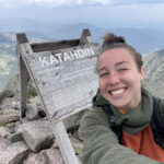
Katahdin, Maine
View our guide for accessing the Trail’s northern terminus, Katahdin, in Baxter State Park in northern Maine.
Guide to Accessing Katahdin