Connecticut – Bridge Closure & Trail Reroute – Macedonia Brook (UPDATED 12/15/23)
Connecticut
closure
|hiking-safety
|reroute-detour
|Alert
12/15/2023
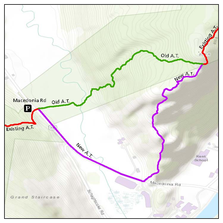
Update: In collaboration with a private landowner, the Appalachian Trail (A.T.) has been temporarily rerouted between CT Route 341 and Skiff Mountain Road, which significantly shortens the distance hikers must walk along Route 341 and eliminates the road walk along Skiff Mountain Road. The reroute will stay in place until the Macedonia Brook Bridge can be replaced. See map below.
The reroute mostly follows the original 1930s route of the A.T. along a steep incline past Numeral Rock. Hikers should pay attention between Route 341 and Skiff Mountain Road to be sure they follow the reroute and use caution when walking along Route 341. Hikers should also take extra care to stay on the Trail through this section since it passes through private land and to follow Leave No Trace. Camping along the A.T. in Connecticut is only allowed at designated sites.
—
09/06/2023
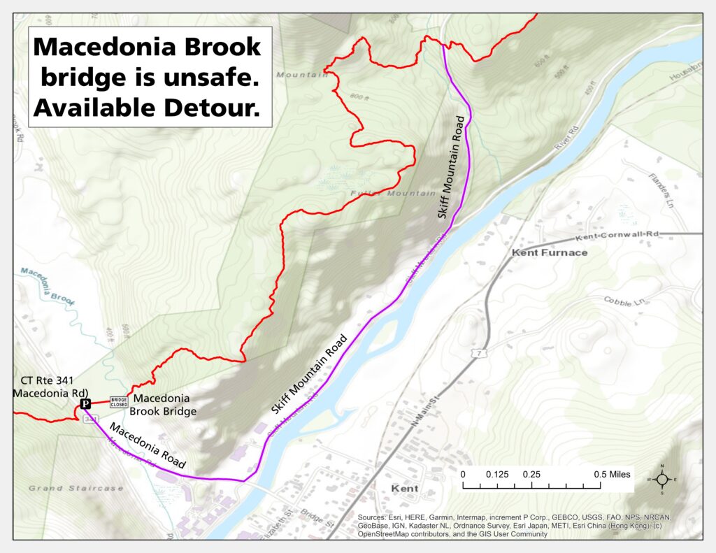
Update: While a period of relatively dry, sunny weather has helped bring river and stream levels back down to normal seasonal levels, the Macedonia Brook Bridge is still not usable. Hikers should continue to follow the detour outlined in the map below utilizing Macedonia Brook Road and Skiff Mountain Road.
—
07/17/2023
Update: The condition of the Macedonia Brook Bridge (NOBO mile 1,471.6) has worsened and the brook is unsafe to ford due to high water levels. Hikers should not use the bridge or ford the river, and instead should use the detour outlined in the map below utilizing Macedonia Brook Road and Skiff Mountain Road.
The detour will be considered the official Trail route for the ATC’s 2,000-miler recognition program. High water persists in the region and more rain is in the forecast. For updated weather, visit weather.gov.
—
07/11/2023
Due to major flooding caused by recent heavy rains, Macedonia Brook Bridge (NOBO mile 1,471.6) has been heavily damaged and may be unsafe to cross. Hikers should not use the bridge and should instead take the detour outlined in the map below utilizing Macedonia Brook Road and Skiff Mountain Road.
Areas along the A.T. from New York through Maine have experienced heavy rains and severe flooding over the last several days. Many river and stream crossings in the region remain dangerous and impassable. For an update on the high water, Trail closures, and how the state of emergency in Vermont is impacting the A.T., visit our high-water update.
We will update this notice with more information about the status of the bridge as it becomes available.
Note that the originally published version of this update outlined a detour using a blue-blazed side trail. The detour on the map below is correct and should be used.