Decoding the Appalachian Trail: Volume 1
Mar 24, 2023

Mar 24, 2023
The Appalachian Trail Conservancy (ATC) is a nonprofit organization that oversees the protection, management, and advocacy efforts for the world’s longest hiking-only footpath, the Appalachian Trail (A.T.). It’s a big job, and the Trail needs lots of supporters to ensure its protection. For that to happen, we believe the A.T. can and should be accessible for all — the more people who enjoy the Trail, whether in person or from afar on our many online platforms, the larger and stronger our community of A.T. lovers and advocates can be.
To help bring a greater understanding of the A.T. and its thriving community of hikers, volunteers, doers, and dreamers, our “Decoding the Appalachian Trail” series will define the words, phrases, and symbols associated with the A.T. to help remove some of the barriers to accessing the Trail — in particular, some of the terms and definitions that are frequently used by A.T. visitors and supporters. Getting to the Trail and enjoying the awe-inspiring landscapes, thriving communities, and many recreation opportunities takes a little bit of knowhow, and the ATC is here to help!
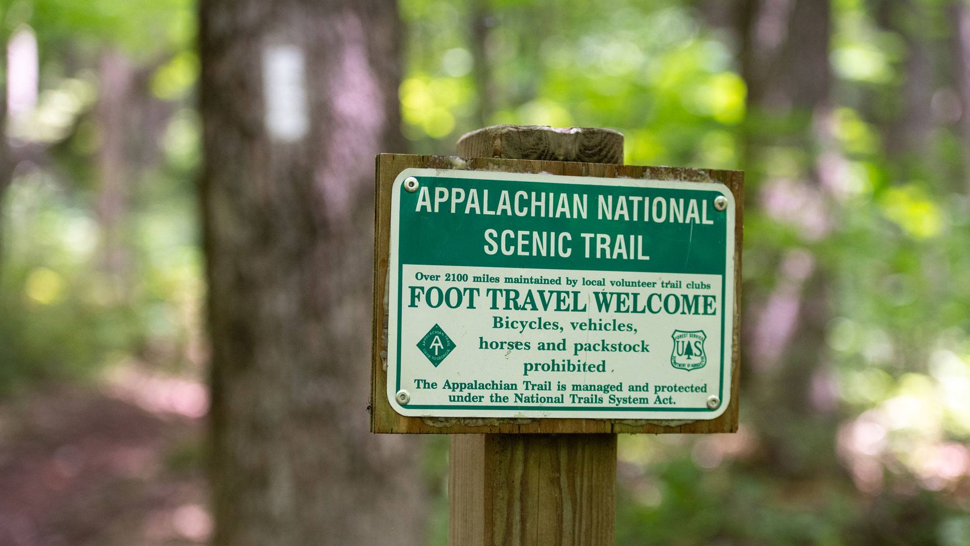
Blazes: The A.T. is marked in both directions (north and south) by 6”x2” rectangles of white paint on trees and posts called “blazes.” A.T. side trails are marked using different colored blazes, most often blue. The boundary of the Trail corridor — where A.T. lands end and land owned by someone else begins — is marked using bright yellow blazes. In some rare instances in high elevation areas where trees don’t grow (called the “tree line”), the Trail may be marked by yellow blazes to help make the path more visible in snow and foggy conditions.
Boundary Monument: A metal survey marker used to highlight the boundary of the A.T. corridor. The boundary line between monuments is marked with yellow blazes on trees. Learn more about the ATC’s Boundary Monitoring Program.
Cairn: A small, man-made pile or stack of stones that serve as a Trail marker in places where blazes cannot be used like above tree line, or where fog and snow might obscure blazes.
Survey Marker: Benchmarks (survey marks, survey monuments, or geodetic marks) are objects placed to indicate key survey points along the Earth’s surface. On the A.T., you might see these markers on summits and high points.
Trailhead: The A.T. has a northern terminus (aka “end”) at Baxter State Park in Maine, and a southern terminus at Springer Mountain in Georgia. In between, there are many trailheads — beginning points for sections of the Trail. Many trailheads also have parking areas available for visitors. Click here to learn more about getting to the Trail and parking.
Alpine Zone: A region above the tree line and on mountains characterized by the absence of trees. Alpine zones along the A.T. contain rare and fragile vegetation, so it is critical to remain on the Trail in these areas. Camping is not allowed in alpine zones in New England.
Bear Boxes: Bear boxes are large locking boxes that Trail visitors can use in some locations along the A.T. to store food securely away from bears. Because bear boxes are not available at every campsite, and because they may fill up, it’s recommended to carry a personal bear canister to store food properly on the A.T. Learn more about proper food storage and avoiding encounters with bears.
Bear Cables: Another method of food storage that can be found along the A.T., bear cables help Trail visitors hang their food out of reach of bears. In Great Smoky Mountains National Park, all food must be hung on the provided bear cables, including bear canisters.
Bear Canister: A hard-sided personal food locker that all overnight A.T. visitors should use to properly store their food to avoid bear encounters. Learn more about why the ATC recommends bear canisters for A.T. visitors.
Day Hike: A hike on a Trail section that only takes one day or less. Day hikers typically carry a small pack with the food, water, and essentials they need without any overnight gear.
Dispersed Camping: Camping in an area that is not a designated campsite or shelter. Sometimes called stealth camping, this is allowed along much of the southern half of the A.T. outside of Great Smoky Mountains National Park and other high-use areas like McAfee Knob, Virginia. Dispersed camping requires a high level of Leave No Trace skills to be done properly. Always check camping regulations ahead of time to make sure dispersed camping is allowed. When in doubt, only camp at designated sites. Learn more about campsite selction on the A.T. by clicking here.
Flip-Flop Hike: A method for hiking the entire A.T. that involves starting somewhere in the middle, hiking to one end, returning to the middle, and hiking to the other end, flip-flopping directions.
Green Tunnel: A nickname for the majority of sections on the A.T. running through deciduous forests. When looking down a forested section of the A.T., the surrounding green leaves and fauna give many visitors the impression that they are walking through a literal tunnel.
LASH: An acronym that stands for “long a** section hike.” People who attempt to hike large sections of the A.T. at a time are sometimes referred to as “LASHers.”
Leave No Trace : A set of seven outdoor recreation guidelines/principles that help people leave the places they are recreating in as good (or better!) than they found them. Leave No Trace is not just about picking up trash or making sure you don’t litter — rather, Leave No Trace helps reduce harmful impacts on the planet, animals, other people, and the unique A.T. hiking experience. Learn more about Leave No Trace on the A.T.
NOBO Hike: Short for northbound, a hike that begins at the southern end of the A.T. and finishes at the northern end.
Privy: Sometimes called outhouses or latrines, privies are small buildings, typically near shelters and high-use campsites, that help contain and compost human waste. Learn more about the bathroom situation on the A.T.
Section Hike: A shorter backpacking trip that can last one or several nights and covers a section of a longer trail.
Shelter: A typical shelter, sometimes called a “lean-to” or a “hut,” has an overhanging roof, a wooden floor, and three walls. These structures are great places to get out of wet weather, meet and talk with other hikers, and help reduce impacts on the Trail by concentrating hikers in a relatively small area. Shelters are available for all A.T. users, though they are intended for individual hikers rather than groups. Shelters are available on a first-come, first-served basis and cannot be reserved in advance.
Shoulder Seasons: Periods of time between peak hiking seasons (late spring and summer) and the off season (winter). During these periods, the weather is typically starting to get warmer or colder and can still be wet, cold, and unpredictable. Special care and preparation should be taken when visiting the Trail during shoulder seasons like early spring and fall.
SOBO Hike: Short for southbound, a hike that begins at the northern end of the A.T. and finishes at the southern end.
Thru-Hike: Every year, approximately 3,000 people attempt to thru-hike, or walk the entire 2,100+ miles of the A.T. In order to qualify as a thru-hike, the hiker must be completed within a consecutive 12-month period.
Trail Angel: A term of endearment given to people who provide “Trail magic” in the form of direct kindness and generosity to hikers. Volunteer Trail maintainers, though not typically referred to as “trail angels,” keep the magic of the A.T. alive. Learn more about Trail magic and special considerations for Trail angels to help preserve the A.T. experience by clicking here.
Trail Logs/Logbooks/Registers: A guest book kept at shelters, campsites, and visitor centers along the A.T. All visitors are welcome to look through the books and write their own entries.
Trail Magic: People’s interpretation of Trail magic varies widely but can include finding what you need most when you least expect it; experiencing something rare, extraordinary, or inspiring in nature; or encountering unexpected acts of generosity that restore one’s faith in humanity. See “Trail Angel” above for more information.
Trail Names: A special nickname adopted by long-distance hikers. Trail names can be chosen by the hiker or given by other visitors, and they are a tradition on the A.T. and among the hiking community at large.
Tramily: A combination of the words “Trail” and “family,” Tramily refers to a group of people who spend a lot of time together on a long-distance hike. For many, a tramily is more than just a group of friends. Completing a long-distance hike is physically, socially, and emotionally taxing, and the bonds formed by people going through a uniquely difficult experience are strong and special.
2,000-Miler: A 2,000-Miler is a person who successfully completes all 2,100+ miles of the A.T., whether that is by a thru-hike or a series of section hikes over a period of multiple years. While the Trail is now much longer than 2,000 miles, this traditional term includes all hikers who have accomplished this impressive goal.
A.T. Landscape Partnership (ATLP): A coalition co-convened by the ATC and the National Park Service dedicated to protecting the views and landscapes that are essential to the irreplaceable A.T. experience. Today, the ATLP is comprised of over 100 partner organizations, which range from state and federal agencies to national land trusts and conservation nonprofits.
Conservation: As protectors of the A.T., our goal is to ensure that it can be enjoyed for centuries to come. Conservation refers to our work protecting and caring for the Trail itself and the surrounding A.T. landscape, including the plants, animals, waterways, and views that make the Trail experience. Conservation is generally associated with the protection of natural resources so that they can be properly used. This differs from preservation, which is defined below.
Conservation corridor: A conservation corridor is an uninterrupted area of natural landscapes. Unlike other conservation areas like parks and preserves, conservation corridors are largely linear. The A.T. is a valuable conservation corridor because it provides an uninterrupted north-south landscape through which many species (and adventurous people!) can travel.
Invasive Species: Invasive species are non-natives that are often accidentally introduced into a new ecosystem. These species are harmful because they can quickly out-compete and crowd out native species due to a lack of natural predators, throwing off the balance of an ecosystem. Learn more about the common invasive species on the Trail and what you can do to help.
Preservation: While conservation refers to protecting landscapes and ensuring proper use, preservation seeks protection of nature from use.
Viewshed: A viewshed refers to everything that’s visible on a landscape. When you’re enjoying the view on the Trail — from a sweeping view to a lush forest surrounding you — that’s an example of a viewshed. Learn more about how the ATC works to assess the Trail’s scenic viewsheds.
Wild East: The Wild East is another name for the A.T. Landscape. We believe the A.T. is both the backbone AND the heart of a large, connected landscape that is vital to all forms of life. The Wild East is inclusive of all values that make the A.T. so exceptional. These include natural resources, history and culture, scenic views, recreation opportunities, and unique towns and communities along the A.T. footpath.
Talking the talk is just the first step in getting more familiar with the A.T. Have more questions? Check out our FAQ page to learn more about the Trail.
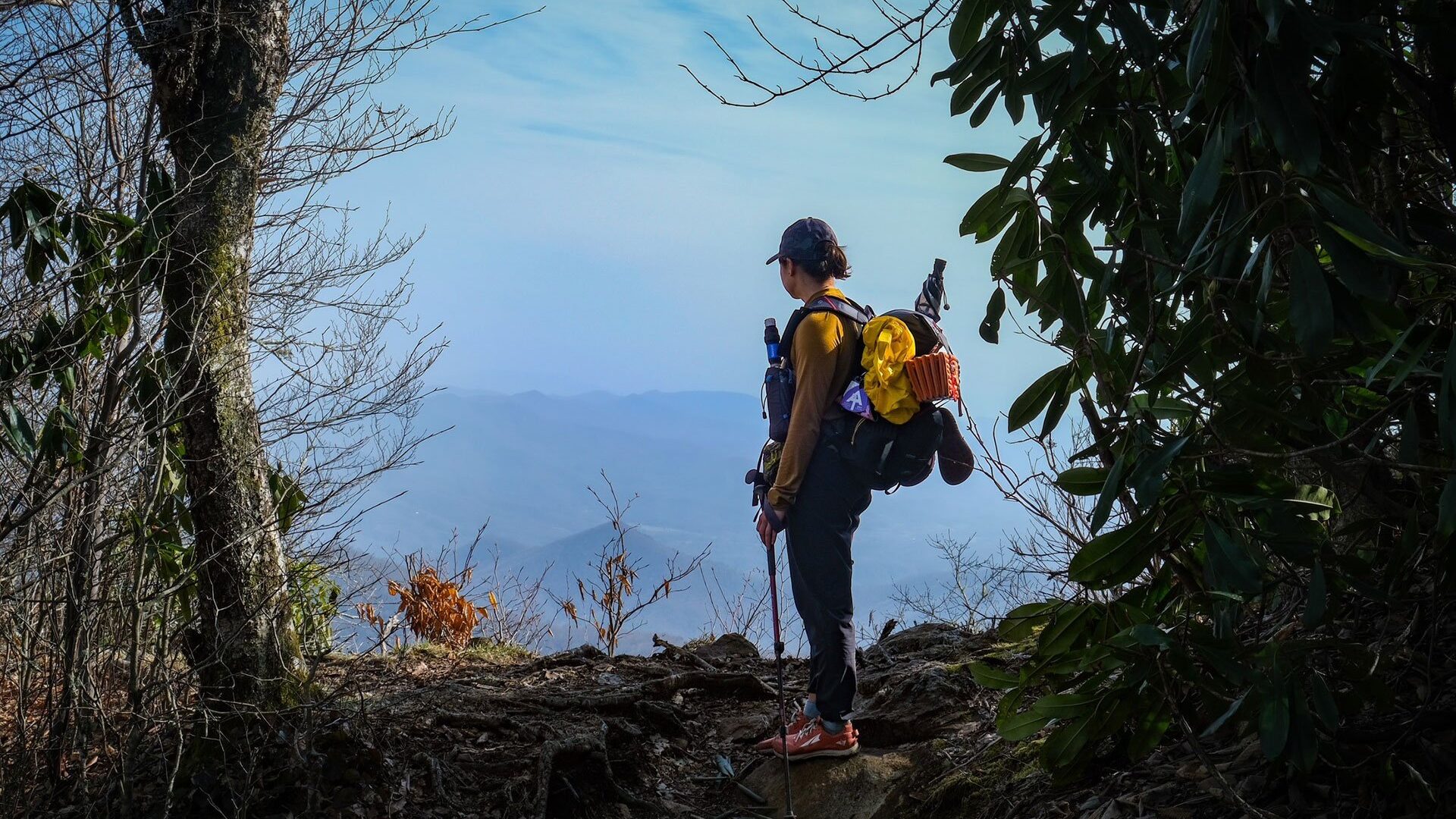
Photo by Patrick Hare
The A.T. is full of special words, phrases, and symbols. As we work to Decode the Appalachian Trail, we need your help! If you know a term that A.T. visitors and enthusiasts need to now, share it with us by filling out the form below!

Join the movement to redefine “take a hike” by signing the definition petition today and unlock $1 for the A.T.
Sign the Petition