


by Laurie Potteiger
14 Reasons to Start Your Northbound Thru-Hike at Amicalola Falls State Park
February 15, 2019
Appalachian Trail (A.T.) thru-hiker season is here! While Springer Mountain, Georgia is the best-known place to start a northbound thru-hike, in fact, more than half of “NOBOs” actually start at another location: Amicalola Falls State Park (AFSP). Here are 14 reasons (one for each of the states the Trail passes through) why you might want to start your thru-hike under the iconic stone arch that marks the beginning of the 8.8-mile Approach Trail, which travels to the southern terminus of the A.T.
1. Get a classic photo under the stone arch.
The stone archway behind the visitor center is the perfect place to launch a thru-hike!
2. Catch the ATC’s Thru-Hiker Orientation class.
Experienced ridgerunners and trail ambassadors offer a brief #StartSmart class in the AFSP visitor center to help you get all the essential info for your hike, including gear selection and last-minute prep tips. They’ve also got you covered with updates on local trail conditions and other things you need to know, including ways to help conserve the Trail during your thru-hike.
3. Pick up your A.T. Thru-Hiker Backpack tag.
After you have registered your thru-hike online (you’ve done that already, right? If not, click here.) and check in at AFSP, you get your official A.T. backpacker tag to hang on your pack and identify you as a thru-hiker (or section-hiker tackling the whole trail). This also shows your commitment to environmentally sustainable practices and Leaving No Trace principles.
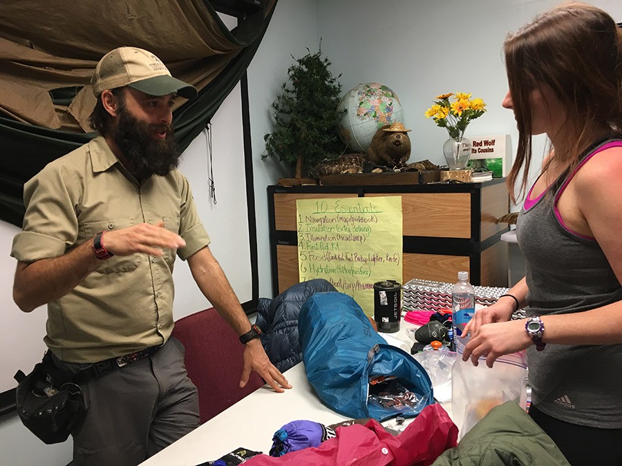
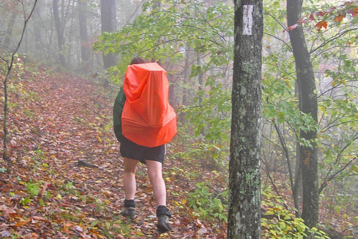
4. Get a pack shakedown.
Is your pack heavier than you’d like? Do you know you have too much stuff but just can’t figure out what to leave behind? Upon request, experienced hikers (an Appalachian Trail Conservancy ridgerunner or a Georgia Appalachian Trail Club Trail Ambassador) are available to evaluate your gear and help you identify unnecessary, impractical, or redundant items, as well as share some favorite long-distance hiker hacks. A lighter pack may increase your chance of success and reduce your chance of injury — and hiking uphill will probably go a lot quicker, too!
5. Weigh your pack and record it in the register for hiker data and for posterity.
Maybe you weighed your pack at home, but maybe you’ve added or subtracted a few Snickers bars since then. Either way, logging the official starting weight of your pack has become a thru-hiker tradition!
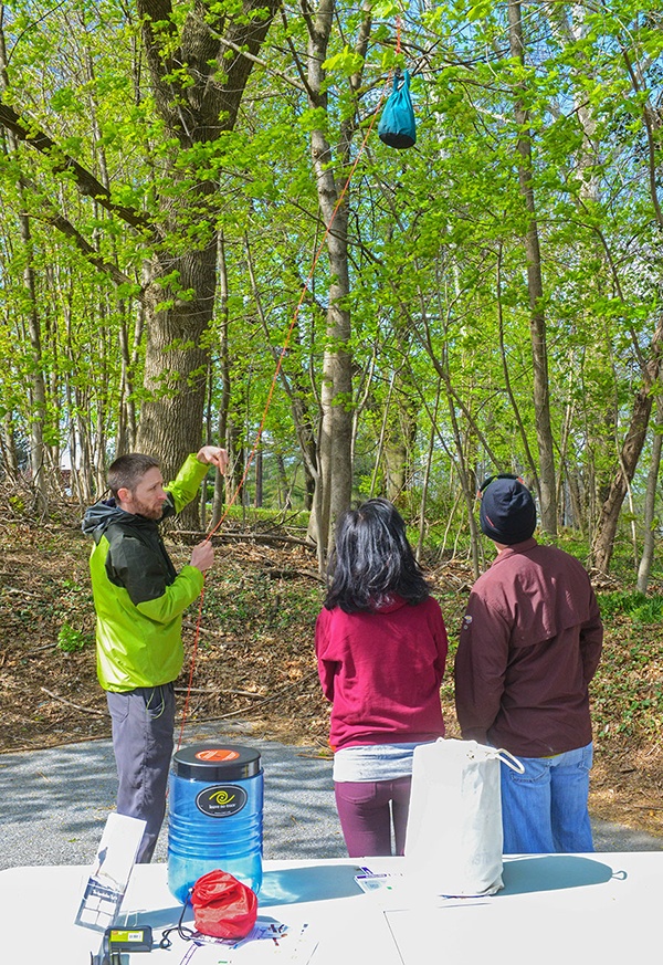
6. Learn about food storage requirements and how to protect your food.
We always recommend using a bear-resistant food container on the A.T., as it is the most effective way to store food and keep you, black bears, and your food safe. Learn what areas of the Trail have specific requirements for food storage, including where new regulations will be implemented. For those who choose to take a chance and hang your food, you can learn the best camping knots, how to make a successful throw, and the most effective way to hang your food bag.
7. It’s crowded at the top.
Springer Mountain is a popular place not only for thru-hikers, but also spring breakers, section hikers, and day hikers from all around the Atlanta metro area. Almost all of them are competing for limited parking space at the Springer Mountain parking lot on Forest Service Road 42, and most then hike 0.9 miles to the summit and back, doubling impacts to the Trail and creating a bottleneck of hikers. Starting you hike via the Approach Trail lets you bypass the parking frustrations and focus on the beginning of your adventure.
8. It will help you figure out whether you’re really ready for a thru-hike.
The 8.8-mile uphill climb on the Approach Trail — not to mention the 604 wooden steps you’ll traverse alongside the park’s namesake waterfalls — will let you know pretty quickly whether you’re truly ready to set off on a 6-month, 5-million-step journey! The first few miles from Springer are downhill and relatively easy, and if you start there you may find yourself in a remote wilderness area before your body’s readiness is tested. Many unprepared hikers have had to bail out in one of the many Georgia wilderness areas the A.T. traverses, where rescue assistance and hiker shuttles might be far away.
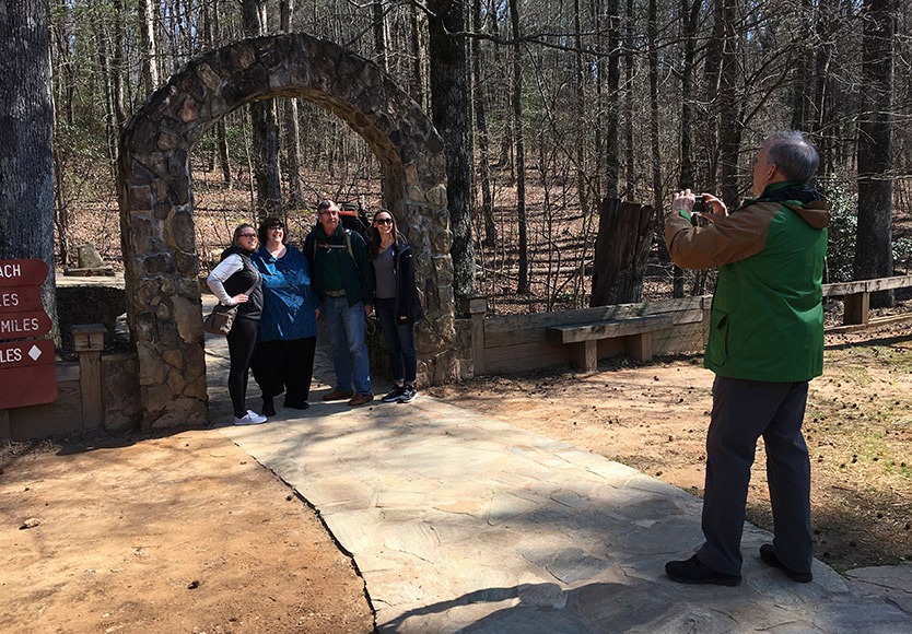
9. Non-hiking friends and family who are seeing you off can take your photo or even get one with you.
The 0.9 mile section of the A.T. that leads to Springer Mountain from the parking lot on Forest Service Road 42 is rugged and rocky in places, making it a hard climb for those with disabilities or who have difficulty walking on uneven surfaces. The Approach Trail arch is very close to a paved parking lot, making it very easy for almost anyone to join you for the beginning of your adventure!
10. Hike a part of the original Appalachian Trail.
Until 1958, the Approach Trail was actually an official part of the A.T. The Trail followed this route between Springer Mountain and Mt. Oglethorpe to the south, which was the A.T.’s original southern terminus. By taking the Approach Trail, you’ll be walking in the footsteps of Earl Shaffer and Grandma Gatewood!
11. Save money if you’re taking a shuttle.
A.T. shuttle drivers often charge extra when taking you all the way to the summit of Springer Mountain. By starting at AFSP, you can save that money for your first big meal in town (or a lot of extra Snickers bars).
12. Help keep Forest Service Road 42 safe for emergency vehicles — and be nice to your car.
If the Springer parking lot on Forest Service Road 42 overflows (as it frequently does during thru-hiker season), many people will park their cars on the side of this narrow, two-way, dirt road. This creates hazards for other drivers and could block emergency vehicles from people who needed them (it has happened in the past!). During February and March, this road is also often deeply rutted and muddy due to freeze thaw, which can lead to stuck cars and undercarriage damage. The road to AFSP is paved and there is plenty of parking, which helps you avoid all of these potential problems that could ruin the first day of your thru-hike.
13. Make your hike official with the ATC.
Yes, there is an online voluntary registration, but that only measures your intent to thru-hike the A.T. Signing in at the park let’s us know that you are fully committed to your hike the entire Trail. Signing the register also helps the ATC keep track of yearly thru-hiker counts.
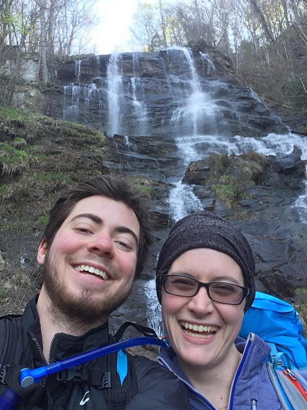
14. See the spectacular Amicalola Falls.
The park’s namesake waterfalls are the tallest in the Southeast and seven times higher than any other waterfall found on the A.T.
We hope this helps you see some benefits in starting your northbound thru-hike at Amicalola Falls State Park that you might not have been aware of before.
Best of luck and Happy Trails!
Discover More
BACK TO THE BASICS
Leave No Trace
Wondering how you can take care of outdoor places like the Appalachian Trail (A.T.)?

Plan and Prepare
Hiker Resource Library
A collection of resources for hikers to stay safe, healthy, and responsible on the Appalachian Trail.
Plan and Prepare
Safety
Learn about the hazards you may face when hiking the Appalachian Trail and how to avoid or prepare for them is the best way to stay safe.