
Connecting Town & Trail
Are you looking for stunning mountain scenery? Small town charm? Natural beauty? A float along the river? Friendly folks? Unique shops? Outdoor recreation?
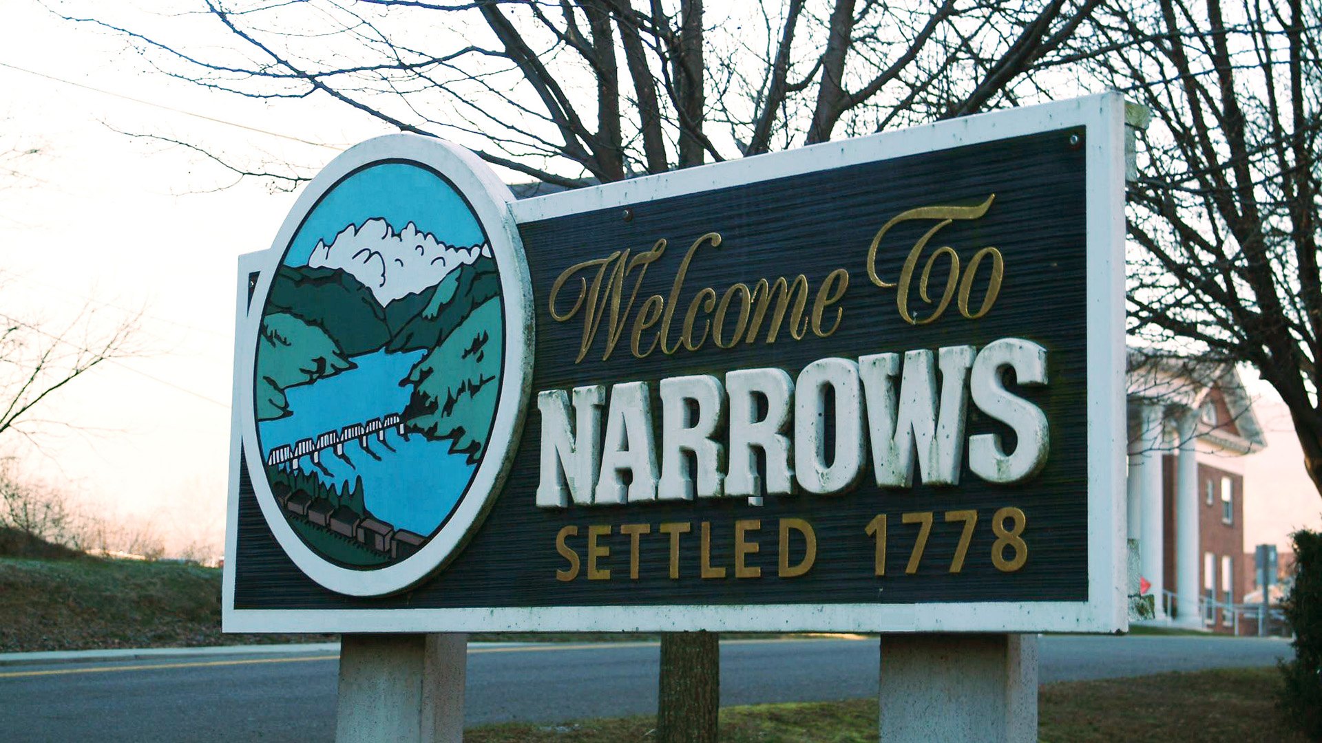
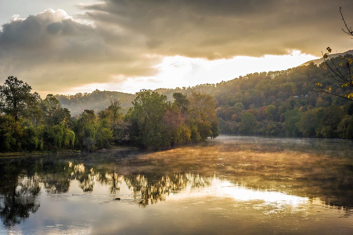
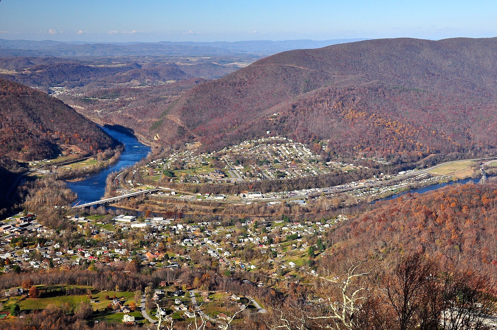
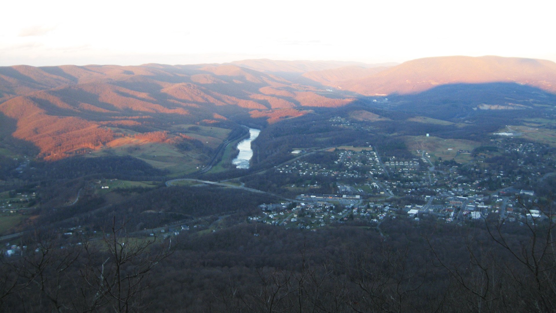
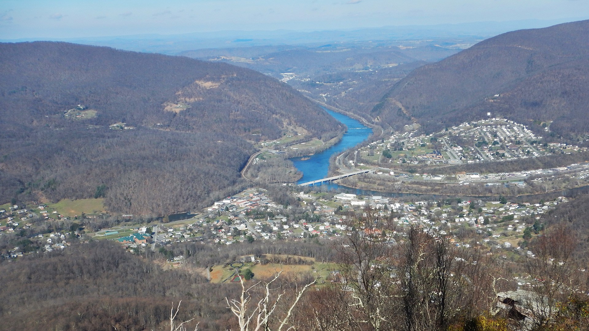
Narrows, settled around 1778, gets its name from the historic “narrows” point where the New River cuts through the ridges of East River and Peters Mountain. Whether you are looking for stunning mountain scenery, friendly folks or fun outdoor recreation, Narrows has it all! Visit and discover the charm, beauty and community of the Narrows.
Plan Your Visit
Narrows Day Trip Suggested Itinerary
A visit to Narrows can begin at the Narrows Town Office, located at 210 Main Street.
Just around the corner on Monroe Street are Centennial Park and The Mural of Narrows. Next door to The Mural is the Narrows Farmer’s Market where visitors can shop for local produce and handmade items. The Veterans Memorial Park is just a few steps away. This is the end of the Veterans Mile, which begins with the Route 61 bridge over New River. Across the street, enjoy the scenery at the duck pond and Mill Dam on Wolf Creek. Don’t forget to snap a picture with the LOVEWorks at the pond.
Pop in to Haven’s Hill Florist (on Monroe Street across from the Farmer’s Market) where you can find local artisan wares, florals, and gifts.
Enjoy lunch at The Iron Skillet on Monroe Street a staple in downtown Narrows. If alfresco dining suits better, make up a picnic lunch from Grant’s Supermarket and head to Centennial Park or the Narrows Town Park (follow Route 61W for about a quarter mile, sidewalks the entire way) and enjoy dining alfresco on the banks of Wolf Creek. The park also offers swimming in the creek, playground equipment and basketball courts.
Walk off that lunch with a hike at Mill Creek Nature Park. This park is located on the edge of town at the end of Northview Street and offers more than 40 acres of natural beauty along Mill Creek. There are miles of trails available for hiking or mountain biking. There are four waterfalls of varying sizes scattered along the trail that provide perfect settings for photographs.
Overnight accommodations could be available at Big Fish Getaways located up Old Wolf Creek Road.
For the more adventurous, Camp Success is located on Lurich Road at the confluence of Wolf Creek and the New River. The campground offers primitive campsites along the river. Registration can be made at the town office.
Rice Field Day Hike
Route type: Out and Back
Hike Difficulty Rating: Moderate to Strenuous
Hike length: 5.2 miles
Follow the Appalachian Trail to an extensive mountaintop meadow with rock outcroppings that offer sweeping views to the west, north, and south. The crest of the Peters Mountain ridge is the West Virginia – Virginia state line. The ascent to the ridge is gently graded, but it is uphill the whole way with just over 1,000 feet of elevation gain. From Pocahontas Road, follow the A.T. white blazes north up a number of switchbacks before an intersection with a rough gravel road that’s closed to traffic. The Trail follows the road a short distance before re-entering the woods – look out for a stone staircase on your left. Above the gravel road, the Trail crosses several rock fields. Keep an eye out for interesting patterns in the rocks—they may be trace fossils known as arthrophycus, tracks made by prehistoric worms burrowing through sand on the ocean floor 435 million years ago. At the crest of the ridge, the Trail crosses an old fence with a ladder stile, then enters the remarkable Rice Field meadow with Rice Field Shelter and privy near the wood line. This is an excellent picnic spot or a great place to view the sunset but remember to bring a flashlight for the return hike! As always, bring a map and compass, make sure your cell phone is charged turned off or and on airplane mode before you head out, and be aware that cell phone reception is often unreliable, especially on mountain slopes.
Driving Directions: From I-81 Exit 118B, follow Rt 460 west. Cross the New River on Senator Shumate Bridge near the Celanese industrial site. Turn right on Rt 641 (Clendennin Road). In 2.3 miles, look for a large brown-and-white sign for Pocahontas Road. There is limited parking available along the shoulder of Clendennin Road. Follow the white A.T. blazes along Pocahontas Road for a short distance and look for the Trail heading up the hill via a set of wooden steps on your left, soon after you cross a cattle grate. LAT: 37.364666 LONG :-80.749794
Mill Creek Waterfall Hike
Route type: Loop
Hike Difficulty Rating: Moderate
Hike length: 4.5 miles
No trip to Narrows is complete without a visit to scenic Mill Creek Nature Park. The 145-acre town park protects the clear, cold waters of Mill Creek as they tumble down the slopes of Pearis Mountain and offers access to a large multi-use trail network that enters the National Forest. Have a picnic in the Adirondack shelter, take your mountain bike all the way to the top of Sentinel Point, or cool off on a summer’s day with a dip in the historic spring-fed reservoir. A favorite day hike is the Waterfall Loop. Hike out of the parking area on the Butternut Trail, an old gravel road. Just past the shelter and historic dam, bear right onto the Waterfall Trail. This narrow, rocky trail follows the shore of Mill Creek as it cascades through large boulders and ends at the Catwalk Trail. Continue uphill when you reach Catwalk, passing through interesting rock gardens—views of the waterfalls will appear on your right. Catwalk ends at a three-way trail junction; from there take Butternut Trail all the way back to the parking lot, enjoying views from the upper slopes of Pearis Mountain on the way.
Driving Directions: From I-81 Exit 118B, follow Rt 460 west. Cross the New River on Senator Shumate Bridge near the Celanese industrial site. About 3 miles after crossing the river, turn right at the light onto Fleshman Street. In 0.2 mile, turn left onto MacArthur Lane, crossing the New River and entering downtown Narrows. Pass MacArthur Inn on the left, then turn left onto Route 100/Main Street. In 0.4 miles, turn right onto VA-652/Northview Street. Follow VA-652 until it ends, and park in the gravel lot on the left just before the gate. LAT: 37.3169412607358 LONG: -80.79334974288942
A.T. CommunityTM Supporters
These businesses support the Trail by taking part in the A.T. CommunityTM Supporter program.
• Iris Brammer Public Library
• Narrows Town Office & Visitors Center
Are you a business in Narrows, VA?
Join the A.T. CommunityTM Supporter Program!


Upcoming Events
Learn about upcoming events and festivals in and nearby Narrows, VA on Giles County’s Facebook page.
View Calendar
Get Involved
Outdoor Club at Virginia Tech (OCVT)
The Outdoor Club at Virginia Tech is a diverse group of outdoor enthusiasts comprised of undergraduate, and graduate students and other members of the Blacksburg community. The goal of the club is to get our members outside and active both physically and socially. The A.T. north of Pearisburg (including Rice Field / Peters Mountain) is maintained by OCVT.
Visit WebsiteATC Volunteer Program
The Appalachian Trail Conservancy is always looking for dedicated volunteers to help maintain the A.T. and assist in our visitor center and headquarters. Opportunities range from greeting visitors and providing information about local hikes to joining a Trail crew for week-long maintenance trips, gaining first-hand experience in what it takes to keep the A.T. open and enjoyable for millions each year.
Learn More