Plan and Prepare
Finding Your Way on the A.T.
Whether you’re out for a short walk on the Trail or preparing for a six-month thru-hike, the tools you use to navigate are critical to having a safe hike and not getting lost.
The Appalachian Trail (A.T.) is marked by white blazes, which are the 2” X 6” inch white painted rectangles. Blazes are painted at regular intervals to help hikers find their way.
While the A.T. is well-marked and well-traveled, it is important to have the proper tools to measure distance between waypoints and to familiarize you with the surrounding landscape in case of emergency. Certain sections of the A.T. are also not as easy to follow as others, such as sections above treeline and in designated wilderness areas.
Always carry a map and compass
 And know how to use them together.
We’ve listed our favorite guidebooks below but no matter what guide you choose to use, every A.T. hiker should carry a paper map in case of emergency. Apps can have glitches, or your cell phone could die, and guidebooks do not show topography or side trail routes.
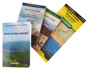
The official A.T. maps are waterproof, durable, and show the land for approximately three miles on either side of the Trail, along with side trails, and roads. These maps also have mile markers and elevation profiles, which is invaluable information for planning your trip, in an emergency, or if you ever get lost on the Trail.
Not sure how to use a map or compass? A.T. Trail Club, the Appalachian Mountain Club, has a guide to get you started. Many outfitters and some Trail Clubs also have orienteering classes to help get you started.
Guidebook Options
Guides/guidebooks options range from basic distance and elevation information for A.T. waypoints (peaks, shelters, water sources, etc.) to detailed descriptions of points of interest. Some guidebooks are also designed to accompany maps, like the official A.T. guidebooks.
Many of the options below are available in our Ultimate Appalachian Trail Store.
FarOut, the Official Hiking App of the A.T.!

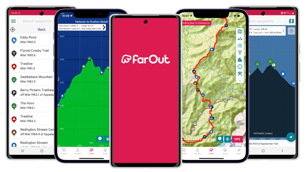
Now the most popular guide among A.T. thru-hikers, FarOut has thousands of points of interest ranging from water sources and campsites to views and hiker services. The app has an interactive map and elevation profiles that show where you are in relation to the A.T. thanks to GPS (even if you don’t have cell service). FarOut users will benefit from expert and up-to-date information on the A.T. provided by the ATC. The app also allows users to comment on waypoints so other hikers can get almost real-time updates on Trail conditions, such as water sources. The FarOut A.T. guide was formerly called Guthook.
Appalachian Trail Data Book

This is the source of the official mileage of the A.T. year each year and the most compact of all the guidebook options. The Data Book is published by the ATC and has all the basic information about the A.T. in a lightweight, packable booklet. The Data Book has a table of distances between major A.T. shelters and road crossings and has limited information about hiker services in Trailside towns.
Note that the Data Book is best used in tandem with the official A.T. Maps. Neither the Data Book nor the maps have detailed information about hiker services in towns.
The Thru-Hikers’ Companion

Published by the Appalachian Long Distance Hikers Association (ALDHA), this is a thoroughly researched guide by long-distance hikers for long-distance hikers.
The Companion includes elevation profiles, distances between A.T. waypoints like shelters and road crossings, and provides maps of towns and communities near the A.T. It also includes detailed information about hiker services.
The A.T. Guide

Like its counterparts, the A.T. Guide includes landmarks and all A.T. waypoints, but in addition it includes the mileage markers and the elevation profile on the same page. The Guide also has information about towns, including maps, and hiker services. This guide uses symbols for quick identification of services and can be purchased as an interactive PDF or as loose-leaf pages so you only carry the sections you need. The A.T. Guide was formerly called AWOL’s Guide and is published by David “AWOL” Miller and AntiGravity Gear.
The Official A.T. Guidebooks

These pocket guidebooks are designed to accompany the official A.T. maps and provide detailed information about each section of the Trail. Along with an overview of each section and descriptions of waypoints, these guidebooks also have interesting facts about local flora and fauna, as well as Trail history. Like the official A.T. maps, the individual guides are published by a combination of the ATC and the Trail Clubs.
ATC’s Interactive Map
While not a guidebook, our free interactive map is a great trip planning tool to get you started. You can turn on different map layers, including parking and shelters, to get an idea of where to access the A.T. and where waypoints are located. You can also see Trail Club sections to learn who to contact for the most up-to-date Trail conditions.
Note that, while the interactive map is a great tool, it does not replace an up-to-date, detailed guide and paper map. The interactive map is meant as a pre-trip planning tool. It is not designed to be used on the Trail.
Other Guides
There are many other guides available in different apps such as AllTrails, Trail Finder, and the Hiking Project. While these can be great resources for finding new hikes, for day hikes, and for starting to plan backpacking trips, we recommend using the other guides listed above for overnight or long-distance trips on the Trail.
Frequently Asked Questions
Should I use a GPS device?
There are many personal GPS devices on the market that utilize satellite GPS location services so you can send your location to loved ones back home, even if you don’t have cell reception (or do not carry a cell phone). Carrying a personal GPS device is up to you. However, if you choose to carry one, we recommend getting a device that has two-way messaging so you can send and receive messages.
Also, keep in mind that there are a few sections of the Trail where it is difficult to even get a GPS signal out, especially in parts of Great Smoky Mountains National Park and Maine.
If I primarily use apps to navigate, how do I keep my phone charged?
A.T. hikers who need to keep their phone charged should carry an extra battery bank. There are very few places along the A.T. with electrical outlets, so hikers without a charger will need to head to town to charge their phones. We also recommend turning your phone on airplane mode unless you need to make a call or send a text. Airplane mode will still allow your phone’s GPS to work with apps like FarOut but will not use up battery in the background searching for service.
We do not recommend using solar chargers on the A.T. Weather on the A.T. can be cloudy for days (or even weeks) at a time and the shade cover of the green tunnel means that, even on sunny days, solar chargers will likely not get enough sun.
Do I really need to carry a paper map?
Yes. Phone batteries die, apps have glitches, and guidebooks do not offer enough information about the surrounding landscape to get you out of an emergency or help you find your way back if you get lost.
What do I do if I get lost on the A.T.?
Visit our Emergencies page to learn more about what to do it if you get lost on the A.T. or if you have another emergency while on the Trail.
