Traveling southbound (SOBO) on the A.T. starts you out on some of the most technically difficult sections of the entire Trail, so it requires some advance planning to have the best possible start to your journey.
Prepare For Your SOBO Hike
Before your hike, brush up on your backcountry safety skills using our Hiker Resource Library. Have a plan for food storage and know where to camp along the Trail.
Your starting point, Katahdin, is located within Baxter State Park. The park is managed for “wilderness first, recreation second” and is purposefully missing amenities like trash cans, running water, stores, or electricity.
A.T. hikers are guests in the park just like other visitors and are subject to park rules and permitting.
Tips for visiting Baxter State Park
Choose Your SOBO Start Date
- Aim to start your SOBO hike between June and mid-July.
- Starting before June 1 is not recommended.
- Baxter typically doesn’t open Katahdin until late May or early June once snow has melted and conditions in the alpine zone can sustain hikers.
- Build buffer time into your plans in case the Hunt Trail (what the A.T. is called up the mountain) opens later than usual.
Reservations & Permits
SOBO hikers must make reservations before arriving in Baxter State Park. You’ll need either a campground reservation or Katahdin Trailhead Pass to enter the park and climb the mountain. Learn more on Baxter’s reservation page.
All A.T. hikers must also secure a Long Distance Hiker Permit at the Katahdin Stream Campground Ranger Station before attempting to summit. Permits are free and must be obtained in person. Baxter State Park permits are in addition to voluntary thru-hike registration on ATCamp.org.
Make Reservations Early
- Make a reservation as soon as possible for your desired dates at Katahdin Stream Campground.
- SOBO thru-hikers are not eligible to stay at The Birches, Baxter’s long-distance hiker campsite.
- If you are driving into Baxter and hiking Katahdin as a day hike, get a Katahdin Trailhead Pass ahead of time. There is no guarantee you will be able to climb the mountain if you arrive day-of with no permit or late.
For complete information on reservations, permits, park rules, and local services, visit our A.T. Hiker’s Guide to Katahdin & Baxter State Park.
Starting Your SOBO Hike
Summiting Katahdin
The Appalachian Trail follows the Hunt Trail up Katahdin, starting at Katahdin Stream Campground.
Your summit of Katahdin will likely take an entire day. At 4,000 feet of elevation gain, it is the greatest sustained ascent on the entire A.T. It is a scramble. Expect to use your hands as you climb over steep boulders and ledges above treeline.
Arrive prepared with everything you’ll need to spend the day on the mountain, including extra food and water.
You shouldn’t plan to do any miles beyond going up and down the mountain. We recommend staying the night before and after your summit at a Baxter campsite or in nearby Millinocket.
We strongly recommend that you not bring your full pack up Katahdin.
Many consider Katahdin as the hardest climb on the whole A.T. and your pack will likely be full of food for one of the Trail’s longest sections between resupplies: the 100 Mile Wilderness. Many SOBOs don’t have their Trail legs yet, and the park has reported a concerning increase in SOBOs carrying full packs and needing assistance or even rescue off the mountain.
Instead, take advantage of the day packs available at the Katahdin Stream Ranger Station. By bringing only the supplies you need for one day, you can help prevent your hike from ending on day one!
Baxter State Park after Katahdin
Leaving Katahdin Stream Campground southbound, the A.T. crosses Park Tote Road and re-enters the woods opposite the campground sign. The Trail then skirts Elbow and Daicey Ponds and follows the Nesowadnehunk Stream to the Penobscot River. This section is mellow, but there are two stream crossings of Nesowadnehunk Stream, which can be high. There is a high-water bypass trail that avoids the fords.
The A.T. leaves Baxter State Park when it crosses Abol Stream just north of Abol Bridge, nine miles from Katahdin Stream Campground. The next A.T. campsite is Hurd Brook Lean-to, another 4 miles south.
Into the 100 Mile Wilderness
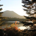
After crossing Abol Bridge and the Golden Road, you’ll enter the famed 100 Mile Wilderness. This is one of the most remote sections of the Appalachian Trail. There are no public road crossings in this 100-mile section between Abol Bridge and Monson, though there are logging roads at various points along the way.
Before entering the 100 Mile Wilderness:
- Carry 7-10 days of food.
- Know how much food you require per day before you start your hike. Resupplies and leaving the Trail are difficult in this section without private arrangements.
- Do not arrange to have food left for you, as unattended food can attract wildlife.
- Expect little to no cell phone service. Some high points and lakeshores may have service from certain carriers.
- Let your loved ones know ahead of time that you may be hard to contact during this stretch.
You’ll be learning more about your hiking style in this section, so allow yourself the time to find what suits you.
Arriving in Monson
Monson is the first trail town (and A.T. Community) south of the 100 Mile Wilderness. The town has lodging options, plus stores with limited resupply and restaurants
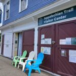
Be sure to stop by the Monson A.T. Visitor Center, open seasonally, to pick up your A.T. hangtag and chat with staff and volunteers about Trail conditions further south.
Hiking Maine in Summer
As you continue your SOBO hike through Maine, you’ll be rewarded with some of the most beautiful scenery the A.T. has to offer. That said, Maine is also considered by many to be the hardest section of the A.T. due to its challenging terrain and remoteness.
Expect Rugged Terrain
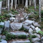
Be ready to hike over rocks, roots, and mud rather than a smooth footpath.
- Be prepared for wet, cold weather at any time.
- Pockets of snow in the high mountains can stay through late May.
- June sees consistent rain.
- Severe thunderstorms are common in early summer but can happen anytime.
Bring a Head Net for Insects
If you start in June, you will encounter insects. Bring a head net.
- The most infamous are Maine’s black flies, which are out in swarms by late May and jokingly referred to as the unofficial state bird of Maine. They hatch in the cold clear streams and are an indication of healthy and clean water, but their sting hurts and their bites itch for days.
- Mosquito season lasts from May through the beginning of July, but there can be hatches later in the season depending on weather. Deer flies, gnats and horse flies make more local appearances through the early summer months.
- Ticks carrying Lyme disease and anaplasmosis are being found in increasing numbers in Maine as well, though they are present trailwide. Treat clothing and gear with permethrin to help ward off ticks.

Know How to Ford Rivers & Streams
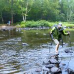
Most stream crossings in Maine do not have bridges. Know what precautions are necessary to ford rivers and streams safely.
- Water levels are highest in May and June when the snow melt is still occurring. The water is also very cold during these months, especially in May.
- River depths also spike after thunderstorms or lengthy rain events during the summer and fall.
John Bilbrey
Do Not Wade or Swim Across Maine’s Kennebec River
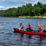
The Kennebec River, the widest unbridged crossing on the entire A.T., has a seasonal ferry service at provided at no-cost to hikers by the ATC. The ferry is in the form of a canoe operated by a licensed guide.
This is the A.T.’s official and historic route; fording the river is extremely dangerous because the water level can rise rapidly and without warning. Two hikers have died fording; every year there are near drownings. The ferry service operates on a fixed schedule during the hiking season. Plan ahead.
Ferry ScheduleCamping Regulations
Campfires are only allowed on the Appalachian Trail in Maine in designated, agency-provided rings at designated overnight sites. Always be sure to practice campfire safety, know the regulations, and check for burn bans before your hike.
Camp only on durable surfaces. In Maine, New Hampshire, and Vermont, camping is not allowed above the treeline due to fragile alpine ecosystems.
Leave No Trace
Hiking SOBO in the South
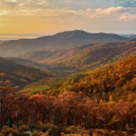
Many SOBO thru-hikers find a great deal of solitude once they reach the southern section of the Trail.
By the time you reach southern Virginia, the traditional hiking season has likely ended. You can take advantage of a less crowded A.T. to connect with nature and enjoy the quiet simplicity of being alone in the woods. Take extra care to stay safe on the Trail, especially if you are hiking alone.
Water Availability
The ATC is hearing more and more from SOBOs that water sources are drying up from Virginia to Georgia in the fall. Be prepared for longer water carries. Chat with hikers you meet about water sources ahead and check FarOut comments. Always carry an extra liter of water.
Fall is Hunting Season Near the A.T.
Be prepared for hunting season starting in September. Hunting is permitted along many parts of the Trail. In fact, the A.T. in Pennsylvania passes through game lands managed primarily for hunting.
Stay safe and aware during hunting season. Plan to wear blaze orange, visible 360 degrees.
Winter is Coming
Be prepared for the possibility of snow and cold weather arriving early along the southern sections of the A.T. in fall. Blizzards can bring wind chills below zero as soon as late October in the high-elevation mountains of Virginia, Tennessee, and North Carolina, including the Great Smoky Mountains National Park.
Have a warmer sleeping bag, clothing, boots, and tall gaiters to keep snow and slush out of your boots.
Always check the weather before heading out of town and pack the 10 Essentials.
Not All Hiker Services Are Available Year-Round
Call businesses and shuttles ahead of time to make sure they’re still open. Have a backup plan just in case.
Happy Trails!
A SOBO thru-hike of the A.T. is a special accomplishment. With proper preparation and perseverance, you’ll soon be standing on top of Springer Mountain and reflecting on your amazing journey.
Continue to monitor your start date on ATCamp.org and contact the ATC with any questions.

Katelyn Bland-Clark