Understanding Camping Rules Along the Trail
Regulations vary considerably along the A.T., especially in the Mid-Atlantic and Northeast regions. This is because the A.T. corridor consists of a patchwork ribbon of many different types of land, managed by more than 75 different agencies. Areas are managed for purposes as diverse as federally designated wilderness, multi-use forests, game lands for hunting, wildlife refuges, watersheds, and farmland.
Most of the regulations pertaining to camping, campfires, and food storage along the A.T. can be found in this table. However, it is important to check regulations before your visit by either contacting the land managing agency, checking an up-to-date guidebook, or contacting us. Always follow posted guidance at shelters, campsites, and signs on the Trail. Trail conditions can change at any time.
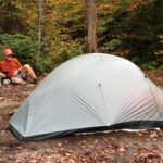
Dispersed Camping on the A.T.
Dispersed camping is when hikers can choose their campsites and do not have to stay at designated campsites or shelters. If dispersed camping is allowed, best practice is to find a site at least 200 feet of the Trail (ideally not visible from the Trail) and 200 feet from water. Dispersed camping is also generally discouraged within 1/4 mile of trailheads, shelters, and established recreation areas. Some sections have more stringent requirements for dispersed camping. Always practice Leave No Trace camping, including forgoing campfires when dispersed camping.
Hikers are required to stay at designated campsites or shelter sites in the Great Smoky Mountains National Park in Tennessee and North Carolina, the Triple Crown/McAfee Knob area of central Virginia, and many areas from Harpers Ferry, West Virginia northward. In areas of heavy use, camping regulations may be designed to concentrate impacts in designated areas to avoid large swaths of the A.T. being devoid of vegetation and areas losing their natural, pristine quality.
Food Storage on the A.T.
Properly storing food, trash, and scented items is not only important for protecting hikers and wildlife along the Trail but is required along many sections of the Trail. The ATC recommends all overnight hikers/backpackers use a bear canister for the duration of their trip on the A.T. Bear canisters are the surest and more flexible method of food storage on the A.T. to prevent bears from accessing human food. Hikers should keep food secured in a bear canister at all times except when actively eating.
Bear Safety & Food StorageCamping Regulations
Some of the land managing areas listed in the tables below overlap with others listed for the same state. Please follow the most restrictive guidelines. When in doubt, plan to only camp at shelters and designated campsites and use a camp stove rather than having a campfire.
“NPS APPA lands” are lands managed by the Appalachian National Scenic Trail office of the National Park Office.
| Area | Additional Landmarks/Waypoints | Campfires | Camping | Food Storage | For add'l info/Info sources | Club |
|---|---|---|---|---|---|---|
| Sections in Maine not listed below | Most of the Trail in ME is on state and NPS APPA land. When in doubt, camp only at designated shelters and campsites. Exceptions are noted below. | Campfires are only allowed at designated sites in Maine except at sites where no fires are allowed (see below) | No camping above treeline. | The A.T. in ME passes through state and NPS lands. On NPS land, proper food storage is required: within a bear resistant container, in provided storage devices, suspended in the air a minimum of 12 ft. off the ground, and a minimum of 6 ft. from the trunks of trees and the suspending or other branches. Food and beverages, food and beverage containers, and garbage must never be left unattended or unsecured along the trail. Sleeping with food or hanging in shelters is prohibited on NPS APPA land. | Appalachian Trail Thru-Hikers' Companion, Appalachian Trail Guide to Maine | MATC/AMC |
| Baxter State Park | Abol Stream marks the park boundary | Fires or other cooking or heating devices are permitted only in designated campsites or picnic areas. At Chimney Pond and Davis Pond, open fires are prohibited and only backpack-type stoves are allowed. | Camping is allowed only in designated campsites in the park; campsites must be reserved in advance. Northbound hikers who have hiked 100+ continuous miles have the option of staying at the first-come, first-served site The Birches (sign-up is at an information kiosk just north of Abol Bridge). Baxter. Camping fee = $10 - $30 | The ATC strongly encourages hikers to use a bear canister or provided food storage devices if available. | Baxter State Park | MATC |
| 100 Mile Wilderness | ME 15 to Abol Bridge | Only allowed designated at fireplace/rings (most lean-tos and campsites) | Some areas off limits to camping except at designated sites: Road crossing S of Nahmakanta Lake to the Pollywog Stream bridge. Gulf Hagas Cut-of trail to N of the W Branch of the Pleasant River. Rainbow Lake. No camping above treeline. | The ATC strongly encourages hikers to use a bear canister or provided food storage devices if available. | Appalachian Trail Thru-Hikers' Companion, Appalachian Trail Guide to Maine | MATC |
| Bigelow Preserve | ME 27 to about 0.6 miles south of Long Falls Dam Road | Only allowed designated at fireplace/rings. No campfires at Horns Pond or Avery Col. | No camping above treeline. | The ATC strongly encourages hikers to use a bear canister or provided food storage devices if available. | MDCAF | MATC |
| Speck Pond | No campfires | Fee = $10 per person | The ATC strongly encourages hikers to use a bear canister or provided food storage devices if available. | Appalachian Trail Thru-Hikers' Companion, Appalachian Trail Guide to Maine | AMC |
| Area | Additional Landmarks/Waypoints | Campfires | Camping | Food Storage | For add'l info/Info sources | Club |
|---|---|---|---|---|---|---|
| White Mountain National Forest (WMNF) | Most of the Trail in NH is on WMNF land except for a few short sections where the Trail crosses state/private land. When in doubt, camp only at designated shelters and campsites. Exceptions are noted below. | No fires in Forest Protection Areas, at Gentian Pond Shelter, or in Great Gulf Wilderness | Camp at designated sites, or 1/4 mi from roads, facilities and water, 200 feet from trail, below alpine zone (where trees are 8' tall or less). Additionally, in Great Gulf Wilderness, no camping within 1/4 mile on Great Gulf Trail between its junctions with Sphinx and Gulfside Trails. Fee required at campsites and shelters managed by AMC and RMC | -Keep sleeping areas, tents, and sleeping bags free of food and odor (like toothpaste or deodorant). -Don’t sleep in clothes you cooked or handled fish or game in. -Never bury or burn food waste. -Hang your food bag at least 10 feet off the ground and 5 feet out from a tree limb that could support a bear, or better yet pack and use bear-resistant containers. -Place sleeping tents at least 100 yards away from food storage and cooking areas. -Never leave your backpack unattended. | White Mountain National Forest | AMC |
| US 2 to ME/NH state line | Fires prohibited except at shelter or designated campsite in fireplace/ring | While this section is still within the WMNF (except for a short section through Leadmine State Forest), hikers are encouraged to only camp at designated shelters and campsites due to the narrow Trail corridor in this section | See regulations above for WMNF. | Appalachian Trail Thru-Hikers' Companion, Appalachian Trail Guide to New Hampshire - Vermont | AMC | |
| Mt. Moosilauke to CT River | Fires prohibited except at shelter or designated campsite in fireplace/ring | While this section is still within the WMNF (except for a few short sections of state/private land), hikers are encouraged to only camp at designated shelters and campsites due to the narrow Trail corridor in this section | See regulations above for WMNF. | Appalachian Trail Thru-Hikers' Companion, Appalachian Trail Guide to New Hampshire - Vermont | DOC |
| Area | Additional Landmarks/Waypoints | Campfires | Camping | Food Storage | For add'l info/Info sources | Club |
|---|---|---|---|---|---|---|
| Green Mountain National Forest (GMNF) | Most of the Trail in VT is on GMNF land except for a few short sections where the Trail crosses state/private land. When it doubt, camp only at designated shelters and campsites | Within campgrounds and other recreation sites, build fires only in fire rings, stoves, grills, or fireplaces provided for that purpose. | Camp at existing sites or 200 feet from trails and water. Do nut cut live vegetation. No camping in alpine or subalpine zones (above 2,500' in elevation and/or where the trees are 8' or less in height) | Except while being consumed, all food and trash containing food materials must be kept in a provided bear box, a bear canister, or hung 12 ft from the ground and not less than 6 ft horizontally from any object. | Green Mountain National Forest | GMC |
| CT River to US 4 | No fires except at shelter in fieplace/ring or Gifford Woods State Park | While this section is still within the GMNF (except for a few short sections of state land), hikers are encouraged to only camp at designated shelters and campsites due to the narrow Trail corridor in this section | See regulations above for GMNF. | Gifford Woods State Park | GMC | |
| Killington | Cooper Lodge and Churchill Scott Shelter | No fires at Cooper Lodge or Churchill Scott shelter. Fires permitted at other shelters only in fireplace/ring. | No camping except at shelters. | See regulations above for GMNF. | Green Mountain National Forest | GMC |
| Clarendon Gorge | No campfires in the vicinity of the gorge | Camping is prohibited in the vicinity of Clarendon Gorge. | See regulations above for GMNF. | Appalachian Trail Thru-Hikers' Companion, Appalachian Trail Guide to New Hampshire - Vermont | GMC | |
| Little Rock Pond | Fires restricted to shelters and designated campsites in provided fireplace/ring | Camping within 0.5 mi of Little Rock Pond is limited to the following designated sites: Little Rock Pond Shelter and Little Rock Pond Tenting area. | See regulations above for GMNF. | Green Mountain National Forest | GMC | |
| Griffith Lake & Peru Peak | Fires restricted to shelters and designated campsites in provided fireplace/ring | Camping within 0.5 mi of Griffith Lake is limited to the following designated sites: Peru Peak Shelter and Griffith Lake Tenting area. | See regulations above for GMNF. | Appalachian Trail Thru-Hikers' Companion, Appalachian Trail Guide to New Hampshire - Vermont | GMC | |
| Stratton Pond and Stratton Mountain | Fires restricted to shelters and designated campsites in provided fireplace/ring. No fires on Stratton Mountain | No camping on Stratton Mountain. Stratton Pond Shelter allows some tenting near the shelter and at the nearby Stratton View Tenting Area. Camping only at designated sites within 0.5 miles of Stratton Pond. | See regulations above for GMNF. | Green Mountain National Forest | GMC | |
| VT 9 to Mass. 2 (North Adams) | The Trail crosses some private land in this section. Hikers should only build campfires in existing rings at designated sites. | The Trail crosses some private land in this section. Hikers should only camp at designated sites. | See regulations above for GMNF. | Appalachian Trail Thru-Hikers' Companion, Appalachian Trail Guide to New Hampshire - Vermont | GMC |
| Area | Additional Landmarks/Waypoints | Campfires | Camping | Food Storage | For add'l info/Info sources | Club |
|---|---|---|---|---|---|---|
| Massachusetts | Campfires are allowed at A.T. overnight sites except at Sages Ravine and Laurel Ridge campsites | Camping permitted only at shelters and designated sites. Groups are encouraged to register on ATCamp. | The A.T. in MA passes through state and NPS lands. On NPS land, proper food storage is required: within a bear resistant container, in provided storage devices, suspended in the air a minimum of 12 ft. off the ground, and a minimum of 6 ft. from the trunks of trees and the suspending or other branches. Food and beverages, food and beverage containers, and garbage must never be left unattended or unsecured along the trail. Sleeping with food or hanging in shelters is prohibited on NPS APPA land. | Appalachian Trail Thru-Hikers' Companion, Appalachian Trail Guide to Massachusetts-Connecticut | AMC Berkshire |
| Area | Additional Landmarks/Waypoints | Campfires | Camping | Food Storage | For add'l info/Info sources | Club |
|---|---|---|---|---|---|---|
| Connecticut | No campfires allowed. | Camping permitted only at shelters and designated sites | The A.T. in CT passes through state and NPS lands. On NPS land, proper food storage is required: within a bear resistant container, in provided storage devices, suspended in the air a minimum of 12 ft. off the ground, and a minimum of 6 ft. from the trunks of trees and the suspending or other branches. Food and beverages, food and beverage containers, and garbage must never be left unattended or unsecured along the trail. Sleeping with food or hanging in shelters is prohibited on NPS APPA land. | Appalachian Trail Thru-Hikers' Companion, Appalachian Trail Guide to Massachusetts-Connecticut | AMC Conn. |
| Area | Additional Landmarks/Waypoints | Campfires | Camping | Food Storage | For add'l info/Info sources | Club |
|---|---|---|---|---|---|---|
| Hudson River to NY/CT border (APPA lands in Putnam and Dutchess Counties) | Fires restricted to shelters and designated campsites in provided fireplace/ring. NY has an annual burn ban from March 16 - May 14 that prohibits open burnings of any kind. | Camping permitted only at shelters and designated sites | Allowed food storage: within a bear resistant container, in provided storage devices, suspended in the air a minimum of 12 ft. off the ground, and a minimum of 6 ft. from the trunks of trees and the suspending or other branches. Food and beverages, food and beverage containers, and garbage must never be left unattended or unsecured along the trail. Sleeping with food or hanging in shelters is prohibited. | Appalachian National Scenic Trail NPS office (APPA) | NYNJTC | |
| Nuclear Lake | No campfires | No Camping | N/A | Appalachian National Scenic Trail NPS office (APPA) | NYNJTC | |
| Harriman State Park/Bear Mountain State Park | Hudson River to NY 17 | Fires are allowed only at designated locations. | Camping permitted only at shelters and designated sites | NY DEC's tips for camping in bear country: (1) Use Bear-Resistant Canisters - This is a highly effective means for preventing bears from getting your food, toiletries and garbage. If you have no choice but to hang your food be sure to use a dark-colored cord. The cord should be 75 feet long and the bag should be hung 15 feet above the ground and at least 10 feet away from trees. (2) Pack a Minimal Amount of Food and Plan Meals to Avoid Leftovers - The less food to store, the better. Use lightweight and dehydrated foods. Eat all that you cook. (3) Cook Before 5 p.m., Away From Your Campsite and Be Clean - Bears generally become active after 5 p.m.; have food stored and site cleaned by then. Choose an area at least 100 feet away from your campsite. Avoid spills and drippings. (4) Keep Food in Storage Containers - Only take out the food you plan to cook. Store food immediately if a bear approaches your cooking area. (5) Never Leave Food Unattended - Bears often watch, hidden in woods, waiting for opportunities to steal food. | Harriman State Park Bear Mountain State Park | NYNJTC |
| NY/NJ line to NY 17/Harriman State Park (APPA lands in Orange and Rockland counties) | Fires restricted to shelters and designated campsites in provided fireplace/ring. NY has an annual burn ban from March 16 - May 14 that prohibits open burnings of any kind. | Dispersed camping is allowed. | Allowed food storage: within a bear resistant container, in provided storage devices, suspended in the air a minimum of 12 ft. off the ground, and a minimum of 6 ft. from the trunks of trees and the suspending or other branches. Food and beverages, food and beverage containers, and garbage must never be left unattended or unsecured along the trail. Sleeping with food or hanging in shelters is prohibited. | Appalachian National Scenic Trail NPS office (APPA) | NYNJTC |
| Area | Additional Landmarks/Waypoints | Campfires | Camping | Food Storage | For add'l info/Info sources | Club |
|---|---|---|---|---|---|---|
| New Jersey | No campfires allowed | Camping in areas other than those designated by signs is prohibited in New Jersey. | The ATC strongly encourages hikers to use a bear canister or provided food storage devices if available. Bears are extremely active along the Trail in NJ. | Appalachian Trail Thru Hikers' Companion. Appalachian Trail Guide to New York-New Jersey | NYNJTC |
| Area | Additional Landmarks/Waypoints | Campfires | Camping | Food Storage | For add'l info/Info sources | Club |
|---|---|---|---|---|---|---|
| Delaware Water Gap National Recreation Area | PA/NJ state line to approx. 1 mile north of Kirkridge Shelter | Stoves only; no campfires, grills or charcoal fires. | Within the recreation area, backcountry camping is permitted only along the Appalachian National Scenic Trail and only for hikers on extended trips. Camping is restricted to through-hikers who are hiking for two or more consecutive days. Camping is limited to one night and ten people per campsite. Self-contained stoves are permitted; ground fires, charcoal stoves and grills are prohibited. Hikers may not camp: Within 100 feet of any stream or water source Within 0.5 mile of an established roadway Within 200 feet of another camping party From 0.5 mile south of Blue Mountain Lake Road to the intersection of the Buttermilk Falls Trail | In any established campground or campsite within the park, food (including lawfully taken fish or wildlife), garbage, and equipment used for cooking or food storage must be stored in such a manner as to prevent wildlife from gaining access to it, except when food is being prepared of consumed | Delware Water Gap National Recreation Area | WTC |
| Wind Gap to Fox Gap | Campfires only allowed at designated sites | Camping only at designated shelters and campsites | Allowed food storage: within a bear resistant container, in provided storage devices, suspended in the air a minimum of 12 ft. off the ground, and a minimum of 6 ft. from the trunks of trees and the suspending or other branches. Food and beverages, food and beverage containers, and garbage must never be left unattended or unsecured along the trail. Sleeping with food or hanging in shelters is prohibited. | Appalachian National Scenic Trail NPS office (APPA) | Batona Hiking Club | |
| Darlington Shelter to Wind Gap (APPA and PA Game lands) | The Trail winds in and out of PA Game Lands from approx. Wind Gap to Darlington Shelter. When in doubt, camp only at designated shelters and campsites. | Yes, except during periods of high fire danger. "Fires must be contained and attended to at all times." | While camping is allowed along the A.T. on game lands, it is specifically prohibited on connecting and side trails under PA Game Commission regulations. Hikers must camp within 200 ft of A.T., at least 500 ft from a stream or spring. Note this exception: between the Susquehanna River and PA 225 on Peters Mountain, camping is only allowed at designated sites. | The A.T. in PA passes through state and NPS APPA lands. On NPS APPA land, proper food storage is required: within a bear resistant container, in provided storage devices, suspended in the air a minimum of 12 ft. off the ground, and a minimum of 6 ft. from the trunks of trees and the suspending or other branches. Food and beverages, food and beverage containers, and garbage must never be left unattended or unsecured along the trail. Sleeping with food or hanging in shelters is prohibited on NPS APPA land | PA Game Commission | Various |
| Windsor Furnace | No campfires except at shelter in fireplace/ring | No camping in Hamburg Watershed except at Windsor Furnace Shelter. No swimming in streams or reservoir. | N/A | Appalachian National Scenic Trail NPS office (APPA) | BMECC | |
| The Pinnacle | No campfires | No camping | N/A | Appalachian Trail Thru-Hikers' Companion, Appalachian Trail Guide to Pennsylvania | BMECC | |
| Cumberland Valley | Alec Kennedy Shelter to Darlington Shelter | No campfires | Due to narrow corridor and nearby neighbors, there is no camping between Darlington Shelter south to Alec Kennedy Shelter except at official Backpacker's Campsite south of Boiling Springs (Train Noise!) | The ATC encourages hikers to use a bear canister or provided food storage devices if available. | Appalachian National Scenic Trail NPS office (APPA) | CVATC |
| Michaux State Forest | The A.T. is almost entirely in the state forest from PA 16 to approx. PA 94. | Open fires prohibited at times of high fire danger, and from March 1 to May 25. This prohibition does not apply to small self-contained camp stoves when used in a safe manner. Other times small campfires are permitted only where adequate precautions are taken to prevent the spread of fire into the forest. All other fires are prohibited. Campfires shall be attended at all times. | Backpackers may camp anywhere except: -In designated Natural Areas -Within 200 feet of a forest road -Within 25 feet of a trail -Within 100 feet of a stream or any open water. Camping prohibited within 1 mile of an adjoining state park. Groups are encouraged to register on ATCamp. | The ATC encourages hikers to use a bear canister or provided food storage devices if available. | Michaux State Forest" | Various |
| Caledonia State Park | From US 30 north for approx. 1.5 miles | Fires only in rings in Park Campgrounds or at grills in picnic areas | Camping only at Park campgrounds. | N/A | Caledonia State Park | PATC |
| Pine Grove Furnace State Park | From Rt. 233 north for approx. 1.5 miles | In fire ring at Park campground (1/2 mile from trail) or at grills in picnic areas. | At Park campground only (March-mid December), 1/2 mile from trail. | N/A | Pine Grove Furnace State Park | PATC |
| Area | Additional Landmarks/Waypoints | Campfires | Camping | Food Storage | For add'l info/Info sources | Club |
|---|---|---|---|---|---|---|
| Maryland | No fires at Annapolis Rocks Campsite. Other shelters and campsites, only in provided fireplace/ring. | Camping in Maryland is only allowed at shelters and designated campsites. Alcoholic beverages are prohibited on all AT lands in MD. Camping is not allowed on the A.T. section in Pen Mar Park, Washington Monument State Park, Gathland State Park, or the C&O Canal Path. | The ATC encourages hikers to use a bear canister or the provided food storage devices at all overnight sites | Appalachian Trail Thru-Hikers Companion, Appalachian Trail Guide to Maryland, West Virginia and Northern Virginia | PATC |
| State | Area | Additional Landmarks/Waypoints | Campfires | Camping | Food Storage | For add'l info/Info sources | Club |
|---|---|---|---|---|---|---|---|
| WV | Harpers Ferry National Historical Park | ~0.5 mile south of Loudon Heights Trail to the Potomac River | No campfires | No camping or fires from Loudoun Heights (WV/VA border) to the Potomac River | N/A | Harpers Ferry National Historic Park | PATC |
| WV/VA | 1.5 miles north of Keys Gap to the Harpers Ferry National Historical Park | 1.5 miles north of Keys Gap to ~0.5 miles south of Loudon Heights Trail | No campfires | Dispersed camping is allowed. Follow Leave No Trace. | Allowed food storage: within a bear resistant container, in provided storage devices, suspended in the air a minimum of 12 ft. off the ground, and a minimum of 6 ft. from the trunks of trees and the suspending or other branches. Food and beverages, food and beverage containers, and garbage must never be left unattended or unsecured along the trail. Sleeping with food or hanging in shelters is prohibited. | Appalachian National Scenic Trail NPS office (APPA) | PATC |
| WV/VA | 1.5 miles south of Keys Gap to the powerline 1.5 miles north of the gap | No campfires allowed | No camping | N/A | Appalachian National Scenic Trail NPS office (APPA) | PATC |
| State | Area | Additional Landmarks/Waypoints | Campfires | Camping | Food Storage | For add'l info/Info sources | Club |
|---|---|---|---|---|---|---|---|
| WV/VA | Harpers Ferry National Historical Park | Potomac River to ~0.5 mile south of Loudon Heights Trail | No campfires | No camping or fires from the Potomac River to Loudoun Heights (WV/VA border) | N/A | Harpers Ferry National Historic Park | PATC |
| WV/VA | Harpers Ferry National Historic Park boundary south to 1.5 miles north of Keys Gap (NPS APPA lands) | 1.5 miles north of Keys Gap to ~0.5 miles south of Loudon Heights Trail | No campfires | Dispersed camping is allowed. Follow Leave No Trace. | Allowed food storage: within a bear resistant container, in provided storage devices, suspended in the air a minimum of 12 ft. off the ground, and a minimum of 6 ft. from the trunks of trees and the suspending or other branches. Food and beverages, food and beverage containers, and garbage must never be left unattended or unsecured along the trail. Sleeping with food or hanging in shelters is prohibited. | Appalachian National Scenic Trail NPS office (APPA) | PATC |
| WV/VA | 1.5 miles south of Keys Gap to the powerline 1.5 miles north of the gap (NPS APPA lands) | No campfires allowed | No camping | N/A | Appalachian National Scenic Trail NPS office (APPA) | PATC | |
| WV/VA | Just south of Ashby Gap to 1.5 miles south of Keys Gap (NPS APPA lands) | No campfires | Dispersed camping is allowed. Follow Leave No Trace. | Allowed food storage: within a bear resistant container, in provided storage devices, suspended in the air a minimum of 12 ft. off the ground, and a minimum of 6 ft. from the trunks of trees and the suspending or other branches. Food and beverages, food and beverage containers, and garbage must never be left unattended or unsecured along the trail. Sleeping with food or hanging in shelters is prohibited. | Appalachian National Scenic Trail NPS office (APPA) | PATC | |
| VA | Sky Meadows State Park | Within ~1 mile of the state park side trail | No fires on A.T. | No camping on A.T.; fee sites available 1.25 mi. east. $15 per person. | Sky Meadows State Park | PATC | |
| VA | G. Richard Thompson WMA | Approx. 0.5 mile south of Manassas Gap Shelter to Whiseky Hollow Shelter; just north of Whiskey Hollow to North Ridge Trail | N/A | Camping only allowed with written authorization. | Camping on WMAs | PATC | |
| VA | Shenandoah National Park (SHEN) boundary to Manassas Gap Shelter | No campfires | Camping only at designated shelters and campsites | Allowed food storage: within a bear resistant container, in provided storage devices, suspended in the air a minimum of 12 ft. off the ground, and a minimum of 6 ft. from the trunks of trees and the suspending or other branches. Food and beverages, food and beverage containers, and garbage must never be left unattended or unsecured along the trail. Sleeping with food or hanging in shelters is prohibited. | Appalachian National Scenic Trail NPS office (APPA) | PATC | |
| VA | Shenandoah National Park (SHEN) | Approx. Rockfish Gap to Tom Floyd Wayside | Fires only at park-constructed fireplaces found at A.T. huts and day-use shelters. | A backcountry camping permit is required and must be obtained online in advance on Recreation.gov Campsites must be at least: - 10 yards away from a stream or other natural water source. - 20 yards away from any park trail or unpaved fire road. - 50 yards away from another camping party or no camping post sign. - 50 yards away from any standing buildings and ruins including stone foundations, chimneys, and log walls. - 100 yards away from a hut, cabin, or day-use shelter. - 1/4-mile away from any paved road, park boundary, or park facility (i.e. campgrounds, picnic grounds, visitor centers, lodges, waysides, or restaurants). No camping between Hogwallow Flats and Gravel Spring Hut | Allowed food storage: within a bear resistant container, in provided storage devices, suspended at least 12 feet above the ground and 6 feet away from the trunk and branches of the tree. Sleeping with food or hanging in shelters is prohibited. | Shenandoah National Park | PATC |
| Area | Additional Landmarks/Waypoints | Campfires | Camping | Food Storage | For add'l info/Info sources | Club |
|---|---|---|---|---|---|---|
| George Washington & Jefferson National Forests (GWJEFF) | From the TN/VA stateline to Rockfish Gap (southern entrance of Shenandoah National Park), most the Trail is on George Washington & Jefferson National Forest land. There are a few areas where the Trail crosses National Park Service, state, local, or private lands and it is not always clearly marked. When in doubt, camp only at designated sites. | Campfires are allowed when you are dispersed camping unless there are fire restrictions in effect due to high fire danger conditions. Between Feb. 15 and April 30 each year, Virginia only allows open air fires between 4 p.m. and midnight. Visitors are strongly encouraged to only use existing fire rings. | Dispersed camping is not allowed in the vicinity of developed recreation areas such as campgrounds, picnic areas, or trailheads. Dispersed camping is not allowed in a one-mile perimeter away from campgrounds and 200 feet from any stream. To prevent resource damage please keep your campsite within 150 feet from a roadway. | ATC strongly recommends storing your food, scented items, and trash in a bear canisters. Use the provided devices (bear boxes, cables, etc.) where available (not available at all sites). We've received more and more reports of bears defeating even proper food hangs (12 feet up, 6 feet from the limb and the tree trunk). Never sleep with your food or hang it in shelters. | George Washington & Jefferson National Forests | RATC et. al. |
| Blue Ridge Parkway (BLRI) lands: Dripping Rock Parking area to Rockfish Gap | Campfires permitted except during times of high fire danger. Use of campstoves is encouraged instead of campfires. | Dispersed camping is allowed in this section except where noted below. No camping within 1/4 mile of any road, within 100 feet of any spring, stream, or other water source. No camping within 500 feet of Paul C. Wolfe Shelter. | Allowed food storage: within a bear resistant container, in provided storage devices, suspended at least 12 feet above the ground and 6 feet horizontally from a post, tree trunk, or other object. Sleeping with food or hanging in shelters is prohibited. | Blue Ridge Parkway | ODATC | |
| Humpback Rocks | No campfires allowed | Camping is prohibited in the area from the spur trail joining the Appalachian Trail to and including Humpback Rocks. Camping is prohibited along the spur trail from the Appalachian Trail to and including the Humpback Rocks Picnic Area. Camping is prohibited at any other location within one-quarter mile of the Blue Ridge Parkway motor road. | N/A | Blue Ridge Parkway | ODATC | |
| Cedar Cliffs | No campfires allowed | No camping | N/A | See area signs, Thru Hiker's Companion, Appalachian Trail Maps for Central VA | ODATC | |
| Reids Gap/VA 664 | No campfires | No camping within 1/2 mile of Reids Gap/VA-664 in both directions | N/A | Blue Ridge Parkway | ODATC | |
| Love Gap Fire Road | No campfires | No Camping on the NPS lands accessed via the Love Gap Fire Road, from the BLue Ridge Parkway to USFS boundary near Maupin Shelter | N/A | Blue Ridge Parkway | TATC | |
| Cold Mountain (Cole Mountain) | No campfires allowed in open area | No camping in open area between signs (0.8 mi) | N/A | See area signs, Thru Hiker's Companion, Appalachian Trail Guide to Central VA | NBATC | |
| Pedlar Reservoir (Lynchburg Reservoir) | USFS 39 to just south of USFS 38 | No campfires allowed around Reservoir. | No camping, swimming, or bathing on land around Reservoir. | N/A | Pedlar Reservoir Rules & Regulations | NBATC |
| Blue Ridge Parkway (BLRI) lands: Black Horse Gap to Punchbowl Crossing | The A.T. in this area is primarily on the National Forest, but traverses BLRI lands for short distances adjacent to the Parkway. These include at Punchbowl Crossing, Petites Gap, Thunder Ridge Overlook area, Cove Mtn summit and most of A.T. between Mills Gap and Black Horse Gap. Look for white rectangular NPS Boundary signs nailed to trees, typically no more than 0.5 miles from the Parkway. | No campfires allowed | No camping on BLRI land. | N/A | Blue Ridge Parkway | NBATC |
| Matts Creek Shelter to James River | No campfires or cookstoves allowed | No camping between the river and the shelter | N/A | George Washington & Jefferson National Forests, Forest Order | NBATC | |
| Apple Orchard Mtn | No trespassing around radar and buildings | N/A | See signs at site | NBATC | ||
| Jennings Creek Road | No fires within 300 feet of road | No camping or fires within 300 feet of road | N/A | Thru Hiker's Companion, Appalachian Trail Guide to Central VA | NBATC | |
| Virginia's Triple Crown area (APPA NPS lands) | VA 624 (Newport Rd., Catawba) to VA 652 (Mountain Pass Rd., Troutville) | No campfires except at designated sites (see list to the right) | No camping except at John's Spring, Catawba Mountain, Campbell, and Lambert's Meadow shelters; and at Pig Farm and Lambert's Meadow campsites. No consumption of alcohol allowed. | Allowed food storage: within a bear resistant container, in provided storage devices, suspended in the air a minimum of 12 ft. off the ground, and a minimum of 6 ft. from the trunks of trees and the suspending or other branches. Food and beverages, food and beverage containers, and garbage must never be left unattended or unsecured along the trail. Sleeping with food or hanging in shelters is prohibited. | Appalachian National Scenic Trail NPS office (APPA) | RATC |
| VA 641 to US 460 | No campfires allowed | No camping | N/A | George Washington & Jefferson National Forests | OCVT |
| Area | Additional Landmarks/Waypoints | Campfires | Camping | Food Storage | For add'l info/Info sources | Club |
|---|---|---|---|---|---|---|
| George Washington & Jefferson National Forests (GWJEFF) | From the TN/VA stateline to Rockfish Gap (southern entrance of Shenandoah National Park), most the Trail is on George Washington & Jefferson National Forest land. There are a few areas where the Trail crosses National Park Service, state, local, or private lands and it is not always clearly marked. When in doubt, camp only at designated sites. | Campfires are allowed unless fire restrictions are in effect due to high fire danger conditions. Visitors are strongly encouraged to only use existing fire rings. | Dispersed camping is not allowed in the vicinity of developed recreation areas such as campgrounds, picnic areas, or trailheads. Dispersed camping is not allowed within one-mile of established campgrounds or within 200 feet of any stream. To prevent resource damage please keep your campsite 150 feet away from any roadway. | ATC strongly recommends storing your food, scented items, and trash in a bear canisters. Use the provided devices (bear boxes, cables, etc.) where available (not available at all sites). We've received more and more reports of bears defeating even proper food hangs (12 feet up, 6 feet from the limb and the tree trunk). Never sleep with your food or hang it in shelters. | George Washington & Jefferson National Forests | MRATC et. al. |
| Partnership Shelter | Fires prohibited except at shelter In fireplace/ring | Camping allowed in shelter only. No camping around the shelter or within 1/4 mile of the shelter. Alcoholic beverages are prohibited in the shelter. | See above: GWJEFF | Appalachian Trail Thru Hiker's Companion, Appalachian Trail Guide to Southwest Virginia | PATH | |
| Grayson Highlands State Park | Signed; Approx. 0.5 mile south of the spur trail to Massie Gap to approx. 0.3 mile north of Wise Shelter | No campfires allowed | No camping in Grayson Highlands State Park except at the fee campground or in Wise Shelter. No camping around Wise Shelter. | Grayson Highlands State Park | MRATC | |
| Wise Shelter | No campfires allowed | Camping allowed in shelter only. No camping around the shelter. | Use the provided bear box. | Grayson Highlands State Park | MRATC | |
| Thomas Knob | No campfires at Thomas Knob Shelter | No tenting around Thomas Knob Shelter | Use the provided bear box, but know that this shelter is extremely popular and fills up quickly. Bring a bear canister in case the box is full when you arrive. | Appalachian Trail Thru Hiker's Companion, Appalachian Trail Guide to Southwest Virginia | MRATC | |
| Town of Damascus | N/A | No camping in town park, including at reconstructed shelter | N/A | Town of Damascus | MRATC |
| Area | Additional Landmarks/Waypoints | Campfires | Camping | Food Storage | For add'l info/Info sources | Club |
|---|---|---|---|---|---|---|
| Cherokee National Forest | From Davenport Gap to just south of U.S. Route 19E, the A.T. follows the NC/TN state line. On the TN side, the Trail is on Cherokee National Forest land. From just north of Overmountain Shelter to the TN/VA stateline, the Trail is entirely on Cherokee National Forest land except around Watauga Lake and in GRSM. | Campfires are allowed. Observe Leave No Trace practices and research local burn bans before you go. | Dispersed camping is allowed. Camping is not allowed within 100 feet of water, trails, trailhead parking lots and developed recreation areas. | ATC strongly recommends storing your food, scented items, and trash in a bear canisters. Use the provided devices (bear boxes, cables, etc.) where available (not available at all sites). We've received more and more reports of bears defeating even proper food hangs (12 feet up, 6 feet from the limb and the tree trunk). Never sleep with your food or hang it in shelters. | Cherokee National Forest | TEHCC |
| Watauga Lake | Shook Branch (US 321) to Wilbur Dam Road | N/A | No picnicking, lingering, or overnight camping including at the former site of Watauga Lake Shelter. | No overnight camping. Never leave food unattended. | Appalachian Trail Thru Hiker's Companion, Appalachian Trail Guide to Tennessee - North Carolina | TEHCC |
| Great Smoky Mountains National Park (GRSM) | Fontana Dam to Davenport Gap | At designated sites in fireplace/ring only | A permit is required. $8 per person per night or $40 per thru hiker (starting 4/30/26 it will increase to $44.50). GSMNP defines thru hikers as anyone starting their at least 50 miles on either side of the park boundary. Hikers must stay in shelters/designated sites. Thru hikers are allowed to tent around shelters if the shelter is full. Thru hikers must give up their spot in the shelter to those with a reservation. | Required to be hung from provided bear cables at overnight sites. Hikers using a bear canister should hang the canister in their pack. | Great Smoky Mountain National Park Permit Info | SMHC |
| Area | Additional Landmarks/Waypoints | Campfires | Camping | Food Storage | For add'l info/Info sources | Club |
|---|---|---|---|---|---|---|
| Pisgah National Forest | From Davenport Gap to just south of U.S. Route 19E, the A.T. follows the NC/TN state line. On the NC side, the Trail is on Pisgah National Forest land. | Keep campfires small, confined, and never unattended. Do not bring in outside wood. Be sure to completely and safely extinguish flames and coals before departure. | Dispersed camping allowed under following conditions: - Hike ¼ mile from trailhead. - 100 ft from the trail itself. - 100 ft from a water source. - ¼ mile away from any developed rec area. | ATC strongly recommends storing your food, scented items, and trash in a bear canisters. Use the provided devices (bear boxes, cables, etc.) where available (not available at all sites). We've received more and more reports of bears defeating even proper food hangs (12 feet up, 6 feet from the limb and the tree trunk). Never sleep with your food or hang it in shelters. | Pisgah National Forest | CMC |
| Max Patch | No campfires | No camping. No fires. Area closes 1 hour after sundown. Reopens 1 hour before sunrise. Visitors prohibited during closed hours. Group size limited to 10. Dogs and other animals must be on a leash no longer than 6 feet, or in a crate or cage. Stay on designated trails. Aircraft may not land nor drop off or pick up anything in this area. Drones are prohibited on Appalachian Trail. No fireworks. Bikes must stay on roads only. Horses and other saddle and pack animals may not be ridden, hitched, tethered, or hobbled in this area. | No camping. Never leave food unattended. | Max Patch Camping Closure Announcement, Pisgah National Forest | CMC | |
| Great Smoky Mountains National Park (GRSM) | Fontana Dam to Davenport Gap | At designated sites in fireplace/ring only | A permit is required. $8 per person per night or $40 per thru hiker (starting 4/30/26 it will increase to $44.50). GSMNP defines thru hikers as anyone starting their at least 50 miles on either side of the park boundary. Hikers must stay in shelters/designated sites. Thru hikers are allowed to tent around shelters if the shelter is full. Thru hikers must give up their spot in the shelter to those with a reservation. | Required to be hung from provided bear cables at overnight sites. Hikers using a bear canister should hang the canister their pack. | Great Smoky Mountain National Park Permit Info | SMHC |
| Fontana Dam | In the vincinity of the Fontana Marina (NC 28) parking lot and just south of Fontana Dam Shelter to the boundary of GRSM | At designated sites in fireplace/ring only | At Fontana Dam Shelter only | |||
| Nantahala National Forest | The Trail is on the Nantahala National Forest in NC south of GRSM, except where is passes by Fontana Dam (see above) | Keep campfires small, confined, and never unattended. Do not bring in outside wood. Be sure to completely and safely extinguish flames and coals before departure. | Dispersed camping allowed under following conditions: - Hike ¼ mile from trailhead. - 100 ft from the trail itself. - 100 ft from a water source. - ¼ mile away from any developed rec area. | ATC strongly recommends storing your food, scented items, and trash in a bear canisters. Use the provided devices (bear boxes, cables, etc.) where available (not available at all sites). We've received more and more reports of bears defeating even proper food hangs (12 feet up, 6 feet from the limb and the tree trunk). Never sleep with your food or hang it in shelters. | Nantahala National Forest | NHC |
| Area | Additional Landmarks/Waypoints | Campfires | Camping | Food Storage | For add'l info/Info sources | Club |
|---|---|---|---|---|---|---|
| Georgia | The Trail is on the Chattahoochee-Oconee National Forest (C-ONF) in GA | No campfires from Slaughter Creek campsite to Neel Gap; otherwise observe Leave No Trace practices | Dispersed Camping is allowed. Observe Leave No Trace practices. | Bear canisters required between Jarrard Gap and Neel Gap March 1 - June 1. Otherwise, ATC strongly recommends storing your food, scented items, and trash in a bear canisters. Use the provided devices (bear boxes, cables, etc.) where available (not available at all sites). We've received more and more reports of bears defeating even proper food hangs (12 feet up, 6 feet from the limb and the tree trunk). Never sleep with your food or hang it in shelters. | Chattahoochee-Oconee National Forest | GATC |