Fall Wildfire Season is Here. You Can Help Make it Uneventful.
Help protect the A.T. landscape, the wildlife that calls the Trail home, and other hikers by taking extra precautions with campfires and camp stoves.
Read MoreIn the past few years, there have been several wildfires on the A.T. Learn how to prevent wildfires and stay safe if one starts on the Trail. Nearly 85% of wildfires are caused by humans. Here are some simple ways to avoid starting one.
Wally Blair
Check our Trail Updates page for temporary burn bans and our Camping Regulations page for campfire rules along the A.T. Campfires are never allowed along the A.T. in New Jersey or Connecticut, and other states like Virginia and Pennsylvania have seasonal bans.
Hot and/or dry and/or windy weather increases the risk of wildfires. Check the weather before you hit the Trail and look for “red flag” warnings and fire advisories. A red flag warning means that an area is experiencing the highest danger of wildfire. Be extra careful with camp stoves and cigarettes during these conditions.
Use a camp stove with an on/off valve to cook with and carry a small electric or solar lantern or fake candle for ambiance. A headlamp strapped to the bottom of a full water bottle also casts a nice light.
If you do have a campfire:
If you come across an abandoned campfire that is still lit/smoldering, put it out and report it.
How to put out your campfire or an abandoned one:
Report abandoned campfires via ATC’s Incident Report. Smokey Bear thanks you for your thoroughness!
Help protect the A.T. landscape, the wildlife that calls the Trail home, and other hikers by taking extra precautions with campfires and camp stoves.
Read More
Wildfires can start suddenly and spread quickly. Learn how to stay safe.
Our Trail Updates page will have the latest wildfire related warnings and closures. You can also sign up for alerts on ATCamp to receive text/email alerts if a fire-related closure starts. Tip for folks at home: you can sign up for ATCamp alerts without registering a hike! The ATC also shares urgent trail alerts on our social media accounts.
Leave the area as quickly and safely as possible, even if that means taking a side trail or backtracking. With the right wind and fuel conditions, a wildfire can spread much faster than a human can run.
The Pacific Crest Trail Association has a thorough article on what to do if you encounter a wildfire on the Trail. While geared toward western hiking, much of the information still applies on the A.T.
Once you are in a safe location, call 911 to report the fire. Make sure you have as precise a location as possible using waypoints like shelters, road crossings, summits, rivers, etc. Remember, most 911 operators won’t know Trail mileage. Always include a Trail feature along with the mileage when reporting a wildfire or other incident.
Once reported to the appropriate authorities, complete an ATC Incident Report if you’re able.
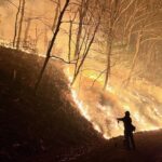
Matts Creek Fire. Photo by USFS.
If you see smoke ahead or on a nearby ridge and don’t know whether or not it’s a wildfire, calling 911 is still appropriate. The dispatchers will know who to contact to determine if the smoke is from something like a prescribed burn or not.
You can also contact the local fire department if you know what county you’re in or contact the local land manager (e.g. National Forest, National Park Service, state game land or park, etc.) if you know whose land you’re on. Otherwise, calling 911 is the fastest way to get connected with the right agency.
Prescribed burns are planned, controlled burns done by trained firefighters and land management agency personnel (U.S. Forest Service, National Park Service, etc.). Prescribed burns are important tools for preventing wildfires by burning fuels in a controlled way before disaster strikes. Prescribed burns also help control the spread of disease and invasive species, maintain critical habitat, renew soil nutrients, and more.
Read more about prescribed burns and their benefits on the U.S. Forest Service website.
Prescribed burn season on the A.T. is typically in the spring before “leaf out” (when deciduous tree leaves unfurl) and fall after leaves have fallen, and most happen on national forests and large swaths of National Park Service land: Georgia, North Carolina, Tennessee, and Virginia (including Great Smoky Mountains and Shenandoah National Parks); and in Vermont and New Hampshire.
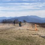
Prescribed Burn at Beauty Spot. Photo by USFS District Ranger Jen Barnhart
ATC posts planned burns on our Trail Updates page. Keep in mind, though, that prescribed burns are weather dependent, and advanced notice is not always possible. Prescribed burns on the Trail will have guards or signage posted at either end of the burn to warn/stop hikers. Always follow instructions from fire crews and posted signs. Temporary closures due to prescribed burns typically only last a few hours but could last a couple of days for larger burns. If thru-hikers need to skip a section due to a burn, they are still eligible to apply for our 2,000-miler program.