Lick Creek: Bridge Washout
VA | Detour
*UPDATED*
21 DAYS AGO
07/09/2026
Update: Maintainers reports that the downed tree was removed. However, Lick Creek remains a hazardous crossing during high water and hikers should continue to wait for the water to recede or turn around.
---
02/26/2026
Update: The Trail maintainers for this section report that Hurricane Helene blew down several trees across Lick Creek upstream of the ford. The trees are high above the water and, if used to cross, requires you to step over from one tree to another midstream. We strongly recommend against using these downed trees to try and cross the stream due to the unstable footing, height above water, and strainers downstream. Strainers are low-hanging branches or blowdowns that could make getting out of the water harder or trap you under water. In this case, the strainers is a large pile of brush just downstream. See the photo below.
Learn more about safety tips for rivers and stream crossings here. And read more about Hurricane Helene storm damage and how to stay safe here.
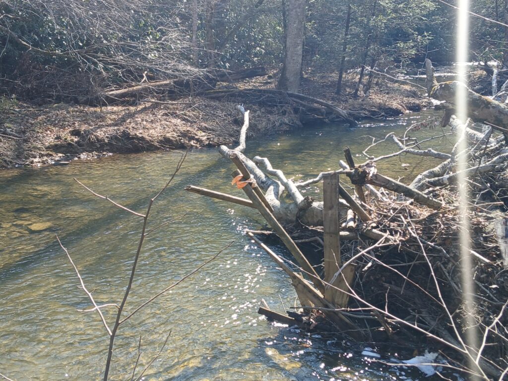
Brush pile ("strainers") downstream of the Lick Creek crossing. Photo by Ed Martin
---
03/24/2025
Update: The bridge project is still ongoing. Hikers should continue to fording the river and use caution during high water.
---
02/07/2023
The George Washington & Jefferson National Forests and the Appalachian Trail Conservancy (ATC) have partnered with the Federal Highway Administration to design and construct a replacement for the Lick Creek footbridge in Bland County, Virginia (NOBO mile 563.8) as part of the national transportation infrastructure program. The new bridge is planned as a replacement in kind – it will be constructed in the same location as the former bridge, but elevated above the floodplain. The design effort is ongoing and includes surveying and geotechnical exploration at the site of the former bridge. These activities are coordinated and approved by the U.S. Forest Service.
Hikers should continue to follow the current route of the Appalachian Trail (A.T.) across Lick Creek, use caution while fording the creek, and be prepared to wait for water levels to go down following heavy rain.
Learn more about safety tips for rivers and stream crossings here. We will update this notice when we have more information.
---
03/25/2020
The A.T. footbridge over Lick Creek in Bland County (mile 563.8) has washed out. Lick Creek is 5.4 miles north of the A.T. trailhead at Virginia Highway 42 (O’Lystery picnic pavilion), and 1.4 miles south of the A.T. trailhead at VA-625 (Poor Valley). Hikers should be prepared to ford the creek, wait out high-water conditions, or backtrack if needed. Lick Creek is typically no more than knee-deep at the A.T. crossing, but may become deeper and more hazardous after a heavy rain. Hikers are encouraged to familiarize themselves with standard safety tips for fording creeks and rivers before hiking this section.