The Community of Formerly Enslaved People at Brown Mountain Creek

Feb 17, 2023

Feb 17, 2023
A short distance away from the town of Buena Vista in central Virginia, where the Appalachian Trail (A.T.) passes through a fairly narrow valley the land around Brown Mountain Creek was home to families, cabins, animals, and fields of crops — a hollow with a history of slavery as well as freedom for African Americans after the Civil War.
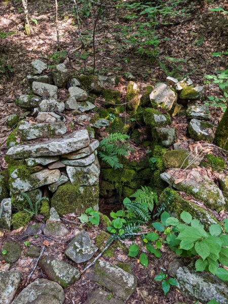
Rock Foundations mark the previous locations of homes, barns, and other buildings at the Brown Mountain Creek community. Photo by Mills Kelly
In antebellum Amherst County, Jesse Richeson owned 217 a plantation of 2, 000 acres, farmed by slave labor, producing corn and tobacco. His property included part of Brown Mountain Creek. He had a son, Mose, by one of his slaves. Mose was a slave but was allowed to work in a mill owned by his father to earn money. It was through this circumstance that Mose had the resources to purchase 220 acres of property at Brown Mountain Creek three years after the war. That purchase made him one of the few formerly enslaved individuals in Appalachia to own land. Furthermore, as his wealth increased, he became one of the largest landowners in the area. He and his sons eventually acquired about 700 acres.
Mose Richeson rented property and cabins to other former slaves who sharecropped the land. At least eleven families lived in this community of formerly-enslaved people at the turn of the twentieth century. Residents grew tobacco, corn, oats, and wheat on the terraced slopes. They collected persimmons, apples, and chestnuts from the trees. A former resident, Taft Hughes, said his family raised chickens, kept a team of horses to use on the fields, and had one cow for milk. A grist mill owned and operated in the village ground grain and corn. Higher on the hill was the community cemetery.
A walk along the A.T. passes hidden clues of those who lived and worked here. The stories of the past are obscured by the thick canopy of reforested woodlands and the slowly diminishing evidence of their homes and barns. However, a careful look reveals rock walls and foundations.
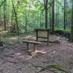
Educational displays inform visitors about the history and significance of the Brown Mountain Creek Community. Photo by Mills Kelly

Click the image above to view this image in a higher resolution. Photo by Mills Kelly
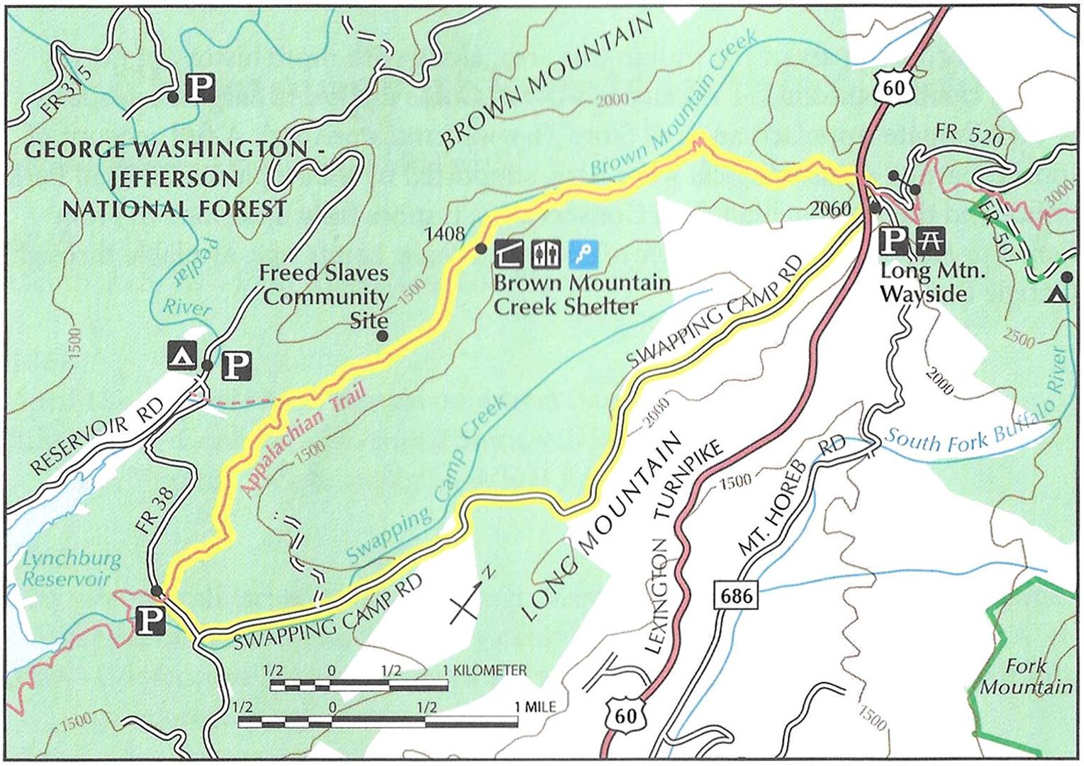
Click the map to view a higher-resolution version.
Distance: 7.2 Miles
Difficulty: Moderate
Trailhead Directions: From Buena Vista, Virginia, travel east on U.S. 60 for 9.3 miles to reach Long Mountain Wayside and parking area with picnic tables, grills, and garbage cans.
Description: This hike begins with a southbound walk on the Appalachian Trail. Locate the Trail from the parking area by crossing the highway on a right diagonal. Descend log steps, and soon cross over a small branch of Brown Mountain Creek. In 1.1 miles, reach an interpretive sign about sharecroppers in the area. Walk with the intention of observing all of the remnants of cabins, barns, and spring boxes. Remember that all visitors can experience the archeology and history of this place when they are observed from a distance. Take photos or draw pictures to remember your visit here, but please refrain from climbing on or moving hand-stacked rocks in this area.
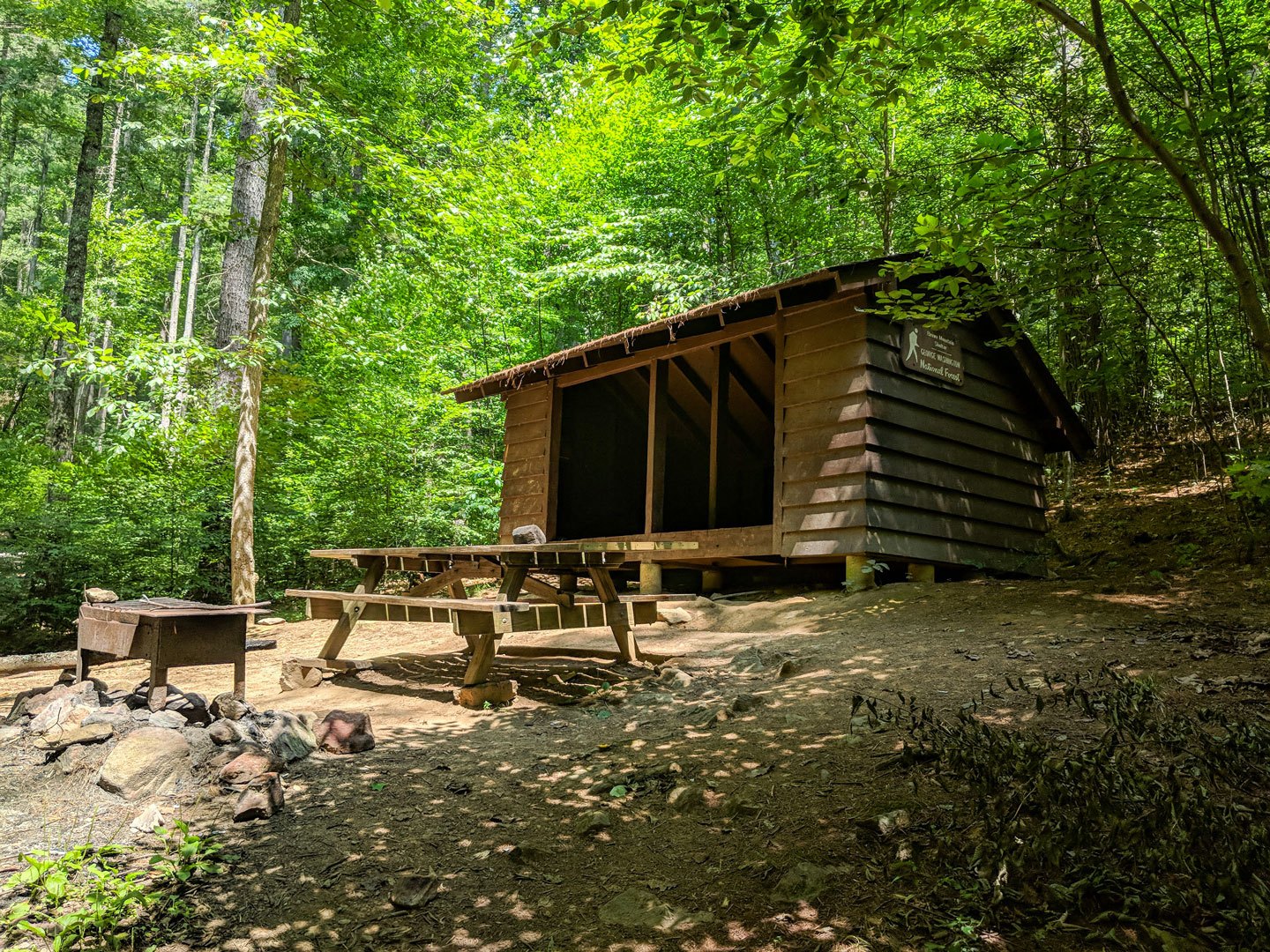
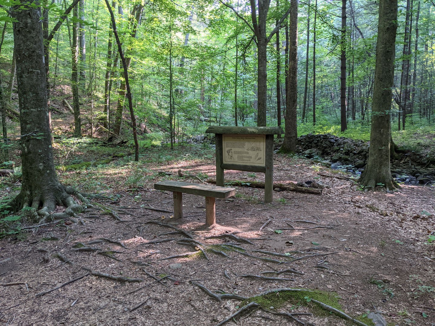
Brown Mountain Creek Shelter. Photo by Mills Kelly
In 0.7 miles, the Trail comes to the Brown Mountain Creek Shelter, which sleeps six and has a picnic table and privy, The Trail south of here crosses the creek on a lovely bridge and continues to kindle the imagination about the lives lived in this valley in the wake of four years of war, In 0.8 mile, hikers encounter another sign on the history of the area and a bench. In another 0.8 miles, cross an old logging road, and then cross a small stream. In a half-mile, reach the junction with a gravel Forest Service road, labeled No. 38 on A.T. maps and also called Swapping Camp Road. Turn left on the gravel road, and ascend the 3.4 miles back to U.S. 60.
This article is excerpted from Hiking through History: Civil War Sites on the Appalachian Trail by Leanna Joyner, Senior Director of Partnerships and Trail Operations for the ATC. Purchase your own copy from our partners at Mountaineers Books and help support our work to protect, maintain, and advocate for the A.T.

Join the movement to redefine “take a hike” by signing the definition petition today and unlock $1 for the A.T.
Sign the Petition