Inside the Appalachian Trail Interactive Map
Jun 11, 2026

Jun 11, 2026
Planning an Appalachian Trail hike just got a lot easier. For the last two decades, the Appalachian Trail Conservancy (ATC) has been a trusted source for essential A.T. data, powering everything from popular hiking apps to conservation planning.
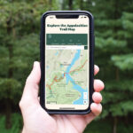
Now, with the latest updates to the ATC’s Appalachian Trail interactive map, you can explore Trail sections in detail, locate shelters, and plan your next hike right from your phone or computer before you ever reach the trailhead.
Learn more about the updates to the interactive map, the history of mapping the A.T., and how maps support the ATC’s work to keep the Trail alive.
The A.T. stretches more than 2,000 miles across 14 states, weaving through forests, mountains, and Trail-side communities. Its scale is staggering—countless access points, ever-changing routes, and a vast network of volunteers and Trail Clubs working year-round to maintain the Trail and its surrounding landscape.
For a trail this long and complex, maps are essential. Hikers rely on them to navigate, volunteers depend on them to plan maintenance, and land managers use them to protect and conserve the corridor of wild lands surrounding the treadway.
Maps also tell a deeper story. They visually capture the immense, collective effort behind the Trail, from local Clubs maintaining miles of footpath to coordinated conservation work across state lines. And like the Trail itself, the ATC’s mapping work has evolved over time.
Photo: Benton MacKaye’s hand-drawn proposed Appalachian Trail

Mapping the A.T. began with traditional paper maps. In 1998, the ATC began its Geographic Information System (GIS) program. Our first two challenges were to map the Trail’s centerline as accurately as possible and to digitize the land tracks by scanning the “segment maps” that had been created by the Land Acquisition Office of the National Park Service.
In 1999, Dr. Vernon “DelDoc” Vernier, volunteered to walk the entire A.T. with a GPS receiver. The centerline that DelDoc collected had some errors due to the limitations of the type of GPS unit that he carried in 1999, so the ATC decided to repeat the process. In 2002, DelDoc set out again, and from 2003–2004, the Trail’s centerline was mapped using GPS with greater accuracy.
Today, the ATC is widely regarded as a leader in Trail mapping among other national park units. Our GIS program has grown into a hub of expertise, with organizations like the National Park Service, land trusts, and Trail Clubs looking to the ATC for spatial data.

Behind every map view is a powerful idea: one centralized dataset.
The ATC maintains a single, comprehensive collection of spatial data that powers everything related to maps. This includes the Trail’s centerline, shelters, campsites, viewpoints, parking areas, and more.
This dataset serves two critical purposes:
In fact, the ATC is the primary source of spatial data for Trail features—information that’s also used by popular hiking apps like FarOut, along with land trusts and partner organizations.

Laurie Potteiger
The Appalachian Trail interactive map is built cooperatively by the ATC and the National Park Service using ESRI’s ArcGIS Online mapping technology. The latest version of the ATC’s interactive map brings meaningful improvements designed with users in mind.
The map is now built on an updated web framework and fully embedded within the ATC’s website. That means smoother performance, quicker loading, and an improved mobile experience when exploring the interactive Appalachian Trail map.
New basemaps make it easier to see surrounding and adjoining trails. This added context helps users better understand how the A.T. fits into a larger trail network, making route planning and navigation more intuitive.
Mileage points have been refined to better align with official ATC guidebooks and popular tools like FarOut. While not exact to the inch, they’re now much closer, helping hikers plan with greater confidence.

You don’t have to be a thru-hiker to benefit from better maps. For all A.T. visitors, the recent enhancements to the interactive map offers layers with the following points of interest along the entire Trail:

Carl Miller
The Appalachian Trail has always been about the journey, which often starts before backpacks are packed and boots are laced. By exploring the ATC’s interactive map, you can discover new sections, plan your next hike, and deepen your connection to one of the most iconic trails in the world from wherever you are.

Give today to get your limited-edition 2027 calendar featuring breathtaking scenes from the Trail.
Reserve my calendar