Behind the Lens of the 2028 A.T. Data Book Cover Photo
Oct 29, 2026

Oct 29, 2026
Did you know that the length and route of the Appalachian Trail changes every year? Since its completion in 1937, the Trail has undergone thousands of adjustments—moving its southern terminus, shifting off of private lands, and rerouting through various states for better views or more sustainable paths—which is why the official mileage fluctuates by a small amount each year. Because the Trail changes each year, the maps and guides that help hikers navigate it must also undergo periodic updates.
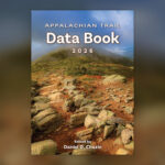
For decades, the Appalachian Trail Data Book has been an essential planning and navigation resource for A.T. visitors, and a new edition is published each year in partnership with Mountaineers Books to reflect the changing Trail. In a lightweight, packable book, hikers can find official A.T. mileage and route information like distances between shelters, road crossings, and key landmarks, as well as elevation and location data.
In 2028, the Data Book will reflect the experience of A.T. hikers on the inside and the outside of the book with a cover submitted by and chosen by the Trail community. Get to know the three finalists and the winning photographer behind the 2028 A.T. Data Book Cover.
The Appalachian Trail and other public lands mean much more to me than just places to hike or explore. They give me the space to step away from the constant stimulation of everyday life. The space to reconnect with myself and with nature. Between the screens, traffic, sirens, and endless distractions of our daily routines, it can be difficult to slow down and truly be present.
I feel most like myself when I’m outside surrounded by the amazing scenery that our public lands have to offer. The mountains feel like home to me, but so does the ocean. Both give me a sense of peace and perspective that is hard to find anywhere else. In many ways, these places keep me grounded.
What makes public lands so meaningful to me is knowing that these places give people the space to slow down and reconnect with something bigger than their everyday lives. Through my photography, I hope to share a little of what these spaces mean to me and encourage others to get outside and experience them for themselves. I also hope people recognize that we all have a responsibility to protect these places so others can continue to enjoy them. Public lands have given me some of the most meaningful moments of my life, and I wish for others to have the opportunity to experience them the same way I have.
Location: Roan Highlands, North Carolina/Tennessee
Over the years, I’ve hiked and photographed various sections of the Appalachian Trail, but Roan Highlands has become one of my favorite places to return to with my camera. I’ve experienced it in many different conditions and light, each visit offering something new.
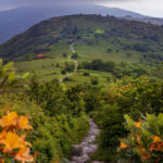
One Wednesday, feeling overstimulated by the busyness of life, I decided to bring my camera with me to work and head for the mountains as soon as I clocked out. I drove nearly 100 miles to Carver’s Gap for a solo sunset hike initially hoping to photograph the rhododendron. Instead, I found myself captivated by the flame azaleas. I was drawn by the way their vibrant orange color stood out against the surrounding green mountain landscape, creating a striking contrast.

It wasn’t the brilliant, colorful sunset photographers often hope for, but the clouds settling over Roan Mountain created a moody, understated beauty of their own. That softer light and overcast atmosphere made the orange flowers stand out even more against the lush green landscape.
Moments like these remind me why I love being outdoors with my camera. I’m simply looking for a photograph; I’m slowing down, noticing the little details, and allowing myself to be fully present in a place that makes the noise of everyday life fade away. Photography gives me a way to hold on to these experiences long after I’ve left a trail or walked away from the beach.
Location: Crawford Path, New Hampshire
Whenever I think of the importance of America’s public lands and the Appalachian Trail, I remember what Pulitzer Prize-winning writer, environmentalist, and historian Wallace Earle Stegner once wrote: “National parks are the best idea we ever had. Absolutely American, absolutely democratic, they reflect us at our best rather than our worst.”
That message is decades old at this point, but it still resonates as strongly as ever. Our public lands allow everyone from all walks of life to visit and explore the millions of acres that we collectively own.

With that in mind, the Appalachian Trail is an American group project. From its first proposal in 1921 to the completion of its first connected footpath in 1937, all the way to today, it has continued to grow. With over 2,000 miles through 14 states, 30 Trail Clubs, and thousands of volunteers, the A.T. is a rare example of a multi-generational project where millions of people over 100 years have worked together to create something special.
As someone who has spent the last ten years exploring thousands of miles on foot, which includes hundreds of miles along the A.T., I have experienced the beauty and fragility of our public lands up close and met the amazing people who dedicate their lives to preserving them. I can confirm Mr. Stegner’s theory that our public lands do, in fact, reflect the best parts of us.
Location: Mahoosuc Range, Maine
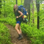
The Appalachian Trail changed my life. Wild natural spaces fill me with wonder and awe, both absolute essentials to my wellbeing as a human on this planet. So the A.T. and other public lands hold a very special place for me. They give me a space to adventure, to challenge myself, to feel small in the universe, and to recharge when things are tough.

The ATC is grateful to everyone who submitted entries for the 2028 A.T. Data Book photo contest, with special thanks to Caroline, Kevin, and Matthew and the Trail lovers who voted for the winning image.
The Appalachian Trail Data Book is available for purchase through our online ATC Trail Store, visitor centers, and select outdoor retailers. Every purchase directly supports our ongoing work to protect, manage, and advocate for the Appalachian Trail for future generations, making the Data Book an essential resource for hikers and a meaningful way to give back to the Trail. The 2027 Data Book will be available for purchase in early 2027.