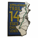
The 14 State Challenge is a great way to visit some of the A.T.’s most iconic places in bite-sized pieces. It can be done on family vacations, when you’re traveling on business, or whenever wanderlust strikes.
How It Works
To complete the challenge, visit a location in each of the Appalachian Trail’s 14 states. Make your goal one blaze, one mile, or even 10 miles in each state. It’s up to you!
We’ve selected notable destinations (that you can drive right to, or within a 1/4 mile of the road) and hikes that are some the shortest, best and most accessible that each state has to offer. You can also explore Day Hikes by State for longer and more challenging hikes.

Fun Things to Add to the Challenge
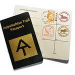

Completed the Challenge?
Download the certificate here and fill out the locations you visited for each of the 14 States. Print it and you’ve got a record of your unique journey!
After you print it, we’d love to have a photo of you with your certificate and hear about how you approached the challenge. Share your photos and stories here.
Download the CertificateSuggested Destinations and Hikes by State
We’ve selected both notable destinations that you can drive right to or are within a 1/4 mile of the road, and hikes that are some the shortest, best, and most accessible that each state has to offer. You’ll see one destination and one hike for each A.T. state, listed south to north, to help you plan and complete the 14 State Challenge.
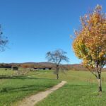
Georgia
Destination: Neel Gap
What’s special: Neel Gap is a mountain pass where the historic Walasi-Yi Interpretive Center, built by the Civilian Conservation Corps in the 1930s, is located. This is the only place on the entire A.T. where the Trail passes through a building. It features a beautiful view of the north Georgia Mountains from the stone porch. For decades the building has housed a legendary outfitter and gift shop. In March and April it’s busy with northbound thru-hikers getting their first taste of civilization.
Closest town: Blairsville, GA
Driving time from closest city: 1 hr. 45 min. north of Atlanta, GA
Map: 12471 Gainesville Hwy, Blairsville, GA 30512
What else? If you go for a hike, you’ll need to park 1/2 mile west at the Byron Reece Memorial Parking lot; from there, it’s a strenuous uphill to reach the Trail, which heads uphill on either side of Neel Gap.
Hike: Woody Gap to Big Cedar Mountain
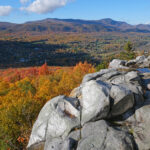
Features: Beautiful view from smooth rock ledge sometimes known as “Preaching Rock.”
- Elevation Gain: 600′ (from 3150′)
- Length: 2 Miles round trip (1 mile up, 1 mile back)
- Closest town: Suches, Georgia
- Driving time from closest City: 2 hrs. 15 min. north of Atlanta, GA
- Map: 34.6777188850811, -83.9996162447849
What else? Although the first half of the ascent is gentle; the second half is a serious workout with rocky footing, requiring you to take some big steps. As soon as you leave the parking lot, you enter the Blood Mountain Wilderness in the Chattahoochee National Forest. Nonetheless, it’s a popular spot; parking lots on both sides of the road may be full on nice weekends. No fees or permits required. A link to the trailhead is below. Order a detailed map here.
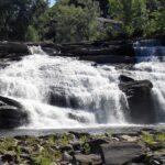
Easier Option: Three Forks to Long Falls is a short, easy hike to a waterfall but requires a lengthy drive on gravel forest service roads.

Rachel Spiker
North Carolina
Destination: Nantahala Outdoor Center
What’s special: From the footbridge over the swift-flowing Nantahala River or a restaurant that sits right above the rapids you can watch kayakers hone their skills in the whitewater. Amp up your own outdoor adventures and add a rafting trip or zipline in this gorge so steep it was known to native Cherokee people as “the land of the noonday sun.”
Driving time from closest city: 1 hr. 15 min. southwest of Asheville, NC
Map: 13077 W Hwy 19, Bryson City, NC 28713
What else? If you go for a hike, expect a really, really long uphill climb in either direction. Heading north the trail is mostly uphill for about 8 miles; heading south, it’s mostly uphill for ten!
Hike: Lovers Leap
Features: Beautiful view of the French Broad River; begin and end in Hot Springs, the ultimate outdoorsy small town for comfort-lovers.
- Length: 2.6 Miles (1.3 up, 1.3 back from center of town, or 1.6 loop from the Silvermine Parking Area).
- Elevation gain: 425′ (start at 1332′)
- Closest Town: Hot Springs, NC
- Driving Time from Closest City: 45 minutes north of Asheville, NC
- Maps: 35.893627, -82.827162
What else? The hike starts out flat and then ascends steadily. Allow extra time to enjoy the town’s restaurants, shops, and array of lodging, or the resort at the town’s natural hot springs after your hike. Maps and services are available from a well-stocked outfitter. The town is steeped in Appalachian Trail lore and fascinating history, which you can learn about by taking the Hot Springs Appalachian Trail Day Hikers Discovery Quest. Free public parking is available in the municipal lot off Andrews Avenue North, a couple of blocks from the Hot Springs Welcome Center (open 10-5). No fees or permits are required.
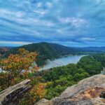
Tennessee/North Carolina
Destination: Kuwohi
What’s special: Nestled in the Great Smoky Mountains National Park, Kuwohi, formerly called Clingmans Dome, is the highest point on the entire A.T., where the Trail reaches an elevation of 6,625 feet near the summit. An observation tower accessed by a circular ramp provides 360 degree views.
Driving time from closest city: 2 hrs. west of Asheville, NC
Map: 35.5568174524504, -83.4961211042948
What else? From the parking lot, walk ½ mile steeply uphill on a paved path. A stop in the park visitor center just beyond the parking area will help you get the most from your trip. Be prepared for temperatures 20 degrees or more cooler than in the valley below. Clingmans Gap Road (the last 7 miles) is closed December 1 – March 31. This is a famous spot in the country’s most visited park, so plan to arrive early in the day, especially in fall. More info here.
Hike: Cross Mountain
Features: An easy walk through mountaintop pastures, with scenic views of surrounding mountains.
- Length: 1.6 Miles (0.8 up, 0.8 back)
- Elevation Gain: 150 feet (start at 3508′)
- Closest Town: Shady Valley, TN
- Driving Time from Closest City: 1 hr. 45 min. north of Asheville, NC
- Map: 36.4814243240086, -81.9607456118847
What else? This section of the A.T. is a hidden gem that was part of the early trail route but only recently relocated back on to the open area when it was acquired for a permanent protected Trail route. The parking lot and trail are universally accessible. No fees or permits.
Virginia
Destination: Damascus
What’s special: The most famous trail town of them all, Damascus is the gateway to the Mount Rogers National Recreation Area in the Blue Ridge Mountains and offers family fun with easy hikes, camping, biking, and B&Bs. And the Trail runs directly through it.
Driving time from closest city: 2 hours southwest of Roanoke
Map: Damascus, Virginia
What else?: Damascus is also known as “Trail Town USA” because several major trails converge here. Outfitters can provide a shuttle you so you can do a 17-mile scenic downhill ride along the Virginia Creeper bike path from Whitetop Mountain. In two hours you can cruise along a route roughly parallel to the A.T. that takes hikers two days to walk. More info here.
Hike: Blackrock Summit
Features: Circle just below a rocky summit on a smooth trail; the adventurous ones can scramble to the top for an even more breathtaking view.
- Length: 1.0 Miles (Loop – 0.6 up on A.T., 0.4 back on Trayfoot Mountain Trail)
- Elevation Gain: 160 feet (start at 2928′)
- Closest Town: Afton, VA by car (Grottoes, VA by straight-line distance)
- Driving Time from Closest City: 1 hour northeast of Charlottesville, VA
- Map: 38.2231099737515, -78.733426026237
What else? This hike is located in the famed Shenandoah National Park, along the beautiful Skyline Drive, at milepost 84.4. Allow plenty of time to enjoy this scenic highway studded with overlooks. You may just see a deer (or a bear) crossing the road (that’s why the speed limit is just 35 mph). An entrance fee of $25 per vehicle is charged, but each year the National Park Service announces several fee-free days.

West Virginia
Destination: The Appalachian Trail Conservancy (ATC) Headquarters
What’s special: ATC HQ, known as the “psychological halfway point” of the Appalachian Trail, is located in the stunningly beautiful and historic town that was the site of John Brown’s raid and Civil War battles. The visitor center features a giant 3-D topographical map of the Appalachian Trail, displays, a hiker lounge, souvenirs, maps and guides, and staff and volunteers to help you explore any aspect of the A.T or local area.
Driving time from closest city: 30 minutes from Frederick, Maryland (1 hour, 15 minutes from Washington, DC and Baltimore, Maryland)
What else? The visitor center is located 1/4 mile from the A.T. and is 1/2 mile from historic lower town. One-hour parking is free while you are visiting the center; staff can explain parking options if you are staying in town longer.
Hike: Two-State Hike Through History
Features: Iconic views from the historic sites of Jefferson Rock, Harper Cemetery, and the confluence of the famed Shenandoah and Potomac Rivers. Dramatic moments in our nation’s history reveal themselves as you walk the A.T. through Harpers Ferry National Historical Park, passing the site of Civil War battles, John Brown’s Fort, and Storer College–one of the nation’s first institutions of higher learning open to all Americans. You can walk on the Appalachian Trail in two states by stepping onto the footbridge across the Potomac that links West Virginia and Maryland.
- Length: 2.0 miles (loop)
- Elevation Gain: 200 feet (from 250′)
- Driving Time from Closest City: 30 minutes south of Frederick, MD (1 hr. and 15 minutes west of Baltimore and Washington, DC)
- Map: 39.3252817, -77.7405101
What else? Start at the Appalachian Trail Conservancy Headquarters, where you can get a map of the hike. Be prepared to be amazed by all the history that unfolds as you take in the indoor and outdoor exhibits. Combine your visit with lunch or dinner at one of the many restaurants in town, or stop for ice cream. While you hike or visit town, park on Washington street for $1/hour (using Parkmobile app, or calling toll-free number). Parking behind the building is free while you are in the visitor center. Staff can direct you to additional parking options.
Maryland
Destination: Washington Monument State Park
What’s special: Washington Monument State Park, located on South Mountain, is home to the first monument dedicated to George Washington, built in 1827. The distinctive stone structure offers a beautiful view of the valley below.
Closest town: Boonsboro, MD
Driving time from closest city: 30 minutes west of Frederick, MD
Map: 39.4989656355905, -77.6234945495519
What else? This is a great spot for viewing migrating hawks and other raptors in September. Follow the wide path of the A.T. for about 850′, and take the side trail of about 250′ to the monument. More info here.
Hike: Weverton Cliffs
Features: Overlook featuring magnificent view of the historic Potomac River, also known as the “Nation’s River.”
- Length: 2 Miles (1 mile up, 1 mile back)
- Elevation Gain: 625′ (Start at 350′, hike to 875′ on A.T., then down to 775′ on side trail)
- Closest Town: Knoxville, MD
- Closest City: 25 minutes southwest of Frederick, MD (Washington, DC and Baltimore are just over an hour’s drive).
- Trailhead Map: 39.3331320468428, -77.6831436927193
What else? This Be prepared: this hike is a workout–but it’s well worth the effort. It’s also quite rocky at the beginning, and rugged in a few places, so you might want to bring trekking poles or a walking stick for balance. But the trailhead is easy to get to, as it’s just 1/2 mile from US 340. Order a map of the A.T. in Maryland here.
Hike Description: From the commuter parking lot, look for a short side trail (about 50′) with blue blazes that leads to the A.T. Turn left to follow the A.T. north, paralleling the road. In a few hundred feet, cross a road, and then ascend stone steps. Follow “switchbacks” 0.9 mile uphill. Where’s there’s a signpost and the A.T. (white blazes turn left uphill) look for blue-blazed side trail down hill to the right. (The view is so popular the sign pointing to it is frequently stolen). Viewpoint is accessed by descending 0.1. No permits or fees.
Alternate Hike Option: Annapolis Rock is a gentler hike to a lovely overlook, but longer, at a total of 4.8 miles.
Pennsylvania
Destination: Boiling Springs
What’s special: The picturesque A.T. Community of Boiling Springs offers something for every season, from walking the A.T. through lush nearby farmland to fly fishing on Yellow Breeches Creek.
Closest Town: Boiling Springs, PA
Driving time from closest city: 30 min. southwest of Harrisburg, PA
Map: 40.147907768614, -77.1245337563683
What else? Enjoy a stroll around Children’s Lake before heading into the ATC Regional Office and Visitors Center to say “happy trails” to staff.
Hike: Table Rock
Features: An easy, almost flat walk along a ridgetop to rock outcropping with views of the Susquehanna Valley.
- Length: 4.2 miles (2.1 out, 2.1 back)
- Elevation Gain: 100 feet (from 1236′)
- Closest Town: Dauphin or Powells Valley
- Driving Time from Closest City: 15 minutes north of Harrisburg, PA.
- Map: 40.4121056542531, -76.9300039131108
What Else? The parking lot is not visible from the road; you know you’re there when you see the footbridge above at the mountain pass on a sharp curve. From the parking lot, you’ll head away from the footbridge, trail north but compass is east No fees or permits required.
New Jersey
Destination: Sunrise Mountain
What’s special: There’s a view of the scenic valley below right from the parking lot, or you can walk to a pavilion with an even more expansive view and enjoy a picnic lunch.
Closest town: Branchville, NJ
Driving time from closest city: 1 hr. 30 minutes north of Newark, NJ
Map: Sunrise Mountain Overlook, Appalachian Trail, Branchville, NJ 07826
What else? It’s 0.2 miles south on the A.T., with an elevation increase of about 40 feet. Parking is free?
Hike: High Point Observation Platform
Features: Views of surrounding countryside and a view of High Point Monument (without the crowds).
- Length: 3 Miles round trip (1.5 up, 1.5 back)
- Elevation Gain: 300′ (from 1375′)
- Closest Town: Wantage, NJ/Port Jervis, NY
- Driving Time from major city: 1 hr. 15 min. northwest of Newark, NJ
- Maps: 41.3027968, -74.66754909999997
What Else? The hike is moderate, with one short steep section. If you want to continue beyond the viewing platform to climb the monument tower, check the hours, which vary. It is closed during winter. The additional ½ mile adds some elevation gain and loss.

New York
Destination: Bear Mountain
What’s special: Drive to the top of Bear Mountain and gain sweeping views of the Hudson River, and on a clear day, the New York City skyline.
Closest town: Bear Mountain, NY
Driving time from closest city: 1 hour north of New York City (also accessible by bus)
Map: 41.3117103562312, -74.0073974786081
What else? At the base of the mountain, you can park near the Bear Mountain Inn, and follow the the A.T. along Hessian Lake a short distance to the Trailside Museum and Zoo, where you can see bears, bald eagles, coyotes and a wide variety of native animals. At the south end of the lake is also an interpretive section of the Trail that showcases the art and science of sustainable trail building. Continue south uphill and you’ll encounter the most impressive rock work on the entire A.T.
Hike: Great Swamp
Features: Boardwalk allows you to keep your feet dry while observing the unique shrub ecosystem of the Great Swamp; cross a lazy river at the foot of a mountain ridge and see if you can spot a beaver dam.
- Length: 1.0 (0.5 up, 0.5 back)
- Elevation Gain: 5′
- Closest Town: Pawling, NY
- Driving Time from Closest City: 1 hr. 15 min. north of New York, NY; 1 hr. 15 min. west of Hartford, CT.
- Map: 41.594899, -73.586915
What else? The A.T. passes by Native Landscaping, a hiker-friendly business where you can get your A.T. Passport stamped or pick up some snacks. You can take the Metro North Harlem line train to the Appalachian Trail Stop right at the beginning of this hike (weekends only). To make a longer day of it, continue up the mountain, or hike through fields on the east side of the road into the Pawling Nature Preserve. If you’re driving, park in the commuter lots 500′ away on either side of the highway; there’s a wide shoulder to walk on.

Connecticut
Destination: Falls Village and universally accessible loop
Description: This small, charming town along the Housatonic River is just a short distance off US 7. The A.T. skirts the town along the east side of river, with a portion of the Trail forming part of a gentle, 1-mile, universally accessible loop. Just below the bridge on the west side of the Housatonic is a picnic area that offers a scenic view of the river. If you’re looking to dine in, the intriguingly-named Toymaker’s Café offers breakfast and lunch and the historic Falls Village Inn offers dinner, a taproom, and overnight accommodations too.
Driving time from closest city: 1 hr. and 15 minutes from Hartford.
Map: See Connecticut hike.
Where else? US 7 parallels the A.T. through Connecticut, and road trippers can find some other lovely towns close to the trail: Kent, Cornwall Bridge, and Salisbury. Bull’s Bridge is a scenic covered bridge and waterfall near Kent, but is best visited on a weekday due to its popularity and limited parking.
Hike: Great Falls
Features: A wide waterfall that is spectacular after heavy rains. The hike follows the Housatonic River, crosses the river on a bridge below the falls, and ascends above the falls providing views from the top.
- Length: 1.4 (0.7 up, 0.7 back)
- Elevation Gain: 100 feet (start at 560’)
- Closest Town: Falls Village
- Driving Time from Closest City: 1 hr. 15 min. northwest of Hartford
- Map: 41.9559902850156, -73.3676935064678
What else? No fees or reservations. See the suggested destination for more details about Falls Village.
Hike details: Heads north from the parking area along Water Street, cross the Housatonic on a newly replaced red iron bridge, and turns right into the woods, heading uphill, with a portion on a hilly country road.
Massachusetts
Destination: Mount Greylock and Bascom Lodge (2.5 hours from Boston)
Description: Take a winding drive to the highest point in Massachusetts. At 3,491 feet, Mount Greylock offers 360-degree views from a 93-foot-tall tower dedicated to war veterans. On a clear day, you can see for 90 miles. After taking in the views, head on over to Bascom Lodge for a meal.
Closest town: North Adams, MA
Driving time from closest city: 2 1/2 hours from Boston.
What else? The road to the summit is open from late May to late October. Partway up the mountain is a fascinating visitor center chock full of interesting and interactive exhibits, with lovely views. The parking fee at the summit is $10 for non-residents, $5 for Massachusetts residents, but you can park at a hiker’s lot a few tenths from the summit at no charge. More info about the summit at here and the lodge here.
Hike: The Cobbles
Features: Start from the charming small town of Cheshire, and follow a gradual climb that gradually gets steeper to a ledge overlooking small villages, a lake, and mountains.
- Length: 2.8 Miles
- Elevation Gain: 650′ (start at 974′)
- Closest Town: Cheshire, MA
- Driving Time from Closest City: 1 hr. 30 minutes northwest of Springfield, MA
- Map: 42.561394, -73.157666
What Else? Park at the Ashuwillticook Rail-Trail parking lot across from the Post Office. Follow the white paint blazes marking the A.T. on telephone poles through town, then turn left into the woods. At the top of the climb, a marked short blue-blazed side trail to the left leads through a grove of mountain laurel to the view. No fees or permits.
Vermont
Destination: Clarendon Gorge
What’s special: What makes this waterfall special isn’t the falls-it’s the hiker’s suspension bridge. This 30-foot long bridge resides directly above the small cascades and is one of the finest hiker’s suspension bridges in New England.
Closest town: Clarendon, VT
Driving time from closest city: 15 minutes south of Rutland
Map: 43.521367620858, -72.925438178082
What else? It’s a tenth of a mile downhill to the footbridge. This section of the Appalachian Trail is also part of the Long Trail, which stretches north all the way to Canada.
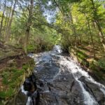
Hike: Thundering Falls
Features: The beautiful Ottauquechee floodplain is crossed by a boardwalk leads to the 150’ Thundering Falls, one of the highest in the state.
- Length: 0.6 (0.3 up, 0.3 back)
- Elevation Gain: 25’ (start at 1,214′)
- Closest Town: Killington
- Driving Time from Closest City: 20 min. east of Rutland, VT
- Map: GPS: 43.6806858, -72.78236070000003
What else? This gentle walk is universally accessible – the only section of A.T. in Vermont accessible to wheelchairs. A 200’ side trail leads to a view of the falls. Parking is free; no permits are required.
New Hampshire
Destination: Pinkham Notch Visitor Center
What’s special: This venerable establishment operated by the Appalachian Mountain Club at the base of Mt. Washington has been serving day-hikers and long-distance A.T. hikers alike for decades. View a 3-D map of the White Mountains, get expert recommendations on local hikes, and be amazed by how much colder the weather forecast for the mountain summits above you are.
Closest town: Jackson, NH
Driving time from closest city: 2 hours north of Portsmouth, NH
Map: 361 New Hampshire 16, Gorham, NH 03581
What else? You can also pick up a map and some gear, and maybe catch a special educational program.
Hike: Rattle River
Features: Follow a lovely stream all the way to a trail shelter by the same name.
- Length: 3.4 (1.7 up, 1.7 back)
- Elevation Gain: 500’ (from 760′)
- Closest Town: Shelburne (near Gorham)
- Driving Time from Closest City: 2 hours 15 min. north of Manchester, NH
- Map: GPS: 44.4009644279864, -71.1095763781769
What else? This section of the A.T. is also known as the Rattle River Trail. No fees or permits required.
Maine
Destination: Monson
What’s special: There are few places where Appalachian Trail hikers are as welcome as in this tiny town on Lake Hebron that serves as the southern gateway to the “100-mile wilderness.” The town boasts four locations where you can get your A.T. Passport stamped, including the A.T. Visitor Center, which provides a wealth of information about the A.T. in the area as well as local attractions.
Closest town: Monson
Driving time from closest city: 1 hour 15 minutes NW of Bangor
Map: Tenny Hill Road, Monson, ME 04464
What else? The A.T. is about 2 miles from town; the friendly staff at the visitor center can give you suggestions for a short hike.
Hike: Piazza Rock
Features: The beautiful Maine woods are the star of this hike, along with the remarkable “Piazza Rock” unique formation.
- Length: 3.8 miles (1.9 up, 1.9 back)
- Elevation Gain: 450’ (start at 1650)
- Closest Town: Rangeley
- Driving Time from Closest City: (2 hours and 15 minutes from Portland)
- Map: GPS: Appalachian Trail Piazza Rock Trail Head 44.886938, -70.540417
What else? Experience the features synonymous with the footpath in the A.T.’s northernmost state: bog bridges and occasional tree roots and mud. In addition to the the striking rock formation, there is also a shelter to visit, a waterfall, and caves for the sure-footed to explore.