Connecting Town & Trail
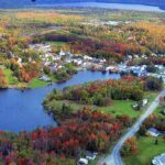
The small town of Monson consists of miles of rolling, forested hills. It is the last town located on the Appalachian Trail, at the beginning (or end) of the Hundred Mile Wilderness—a remote stretch of trail that ends near the famed Mount Katahdin, the northern terminus of the A.T.
Monson was for many years a slate-mining town, and an important part of its history is the Scandinavian immigration to Monson in the late 1800s. A Finnish Hall is located just south of town on Route 15. An old Swedish Lutheran Church (today the AIIA Institute) is currently listed on the National Register of Historic Places.
Monson is now a town that attracts adventurers, free-spirits, and artisans. It is home to a growing arts program, Monson Arts, and continues to delight visitors interested in boating, snowmobiling, cycling, exploring nature, shopping, dining and more!
Plan Your Visit
- Start your day at the Monson General Store to pick up some hot coffee and sandwiches to go. You’ll find some fun gifts here as well.
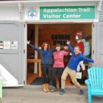
- Stop by the Monson Appalachian Trail Visitor Center to learn more about local hikes.
- Go gift-shopping for pottery, paintings, antiques, and of course some REAL maple syrup.
- Explore the works of local artists at the Monson Arts Gallery.
- Treat yourself to a local craft beer at Turning Page Farm.
- End the day at The Lakeshore House—where the food is only rivaled by the amazing lakeside views—or enjoy some great barbecue at
- Spring Creek Bar-B-Q. If you’re in the mood for fine dining, The Quarry is an excellent choice.
Little Wilson Falls: 1.5 miles each way (3.0 miles round trip)
Difficulty: Moderate
This blue-blazed A.T. side trail follows a series of waterfalls up Little Wilson Stream culminating in the spectacular 40+ foot upper falls. The hike is moderate with some elevation gain. The trail skirts the edge of the stream until it follows a switchback up the slope to higher ground. Particular care should be taken in this area if the rocks and roots are slippery.
At 1.3 miles from the parking lot, the side trail intersects the A.T. Turn left (southbound) to follow the white-blazed A.T. for 0.2 miles to a series of overlooks of the dramatic slate gorge. Turn right (northbound) to access the stream, 0.2 miles from the intersection.
Getting there: From Monson, go north on Route 6/15 for 0.6 mile. Turn right onto Elliotsville Road toward Borestone Mountain. Go 7.6 miles. Turn left onto the dirt road before the bridge over Big Wilson Stream. Low clearance vehicles can park on the left just after this turn and hike in 0.8 miles to the trailhead. Other vehicles can continue 0.5 miles and park at the lot where a road enters from the right or continue straight for another 0.3 miles to the trailhead. There is limited parking at the trailhead.
Borestone Mountain: 2.0 miles each way via Base and Summit Trails to East Peak (4.0 miles round trip; shorter and longer options are also available)
Difficulty: Challenging
Elevation Gain: Approximately 1100 feet from the trailhead to East Peak
Please note that Borestone Mountain is an Audubon Sanctuary. No pets are allowed on Borestone’s trails.
Borestone Mountain’s two peaks offer panoramic views of a vast, forested landscape. To the northeast, there is a view across Lake Onawa toward the Hundred Mile Wilderness section of the A.T. where it crosses the summit of Barren Mountain. From the trailhead, hikers ascend to a Visitor Center on the shore of a small, scenic pond. From there, the path grows steeper and more rugged as hikers climb toward the summit.
Base Trail: This 0.8-mile trail begins from the shale-covered access road, at the first kiosk to the left after entering the gate across from the parking lot. It winds through mature forest and back to the access road, which continues another 0.2 mile to the Visitor Center at Sunrise Pond. Instead of taking the Base Trail, hikers may choose to walk up the access road; the distance is 1.3 miles from the gate up to the Visitor Center. An overlook easily approached from either the Base Trail or the access road offers an expansive view of Greenwood Pond. One good option is to take the Base Trail on the way up, then, on the return hike, to follow the access road back down to the trailhead, with a short detour to the overlook en route.
Summit Trail: From the Visitor Center, the 1.0-mile Summit Trail follows Sunrise Pond’s shore before climbing steeply through spruce and, in its final stage, over exposed rock. Hikers emerge after 0.7 mile onto the summit of the mountain’s West Peak, with the highly recommended choice of continuing another 0.3 mile to the East Peak. Thanks to the Maine Conservation Corps, 130 stone steps help hikers ascend. There are also two steel hand/footholds set in rock.
Getting there: From Monson, go north on Route 6/15 for 0.6 mile. Turn right onto Elliotsville Road toward Borestone Mountain. Go 7.6 miles. Cross the bridge over Big Wilson Stream. Bear left and continue uphill over the railroad tracks. Park in the lot on the left, across from the gate to the shale-covered access road (which is closed to vehicular traffic).
Thanks to Maine Audubon for the Borestone trail descriptions and road directions.
Monson Appalachian Trail Visitor Center
Join us in Monson for help planning safe and enjoyable adventures on the A.T. and other trails in the Hundred Mile Wilderness and Moosehead Lake regions.
Learn More

Get Involved

Maine Appalachian Trail Club
The Maine Appalachian Trail Club (MATC) is an all-volunteer, nonprofit corporation that was organized on June 18, 1935, to assume responsibility for the management, maintenance and protection of the Appalachian Trail (A.T.) in Maine. Learn more and become a member today at matc.org.
Visit Website
ATC Volunteer Program
The Appalachian Trail Conservancy is always looking for dedicated volunteers to help maintain the A.T. and assist in our visitor center and headquarters. Opportunities range from greeting visitors and providing information about local hikes to joining a Trail crew for week-long maintenance trips, gaining first-hand experience in what it takes to keep the A.T. open and enjoyable for millions each year.
Learn More


