


by Oforiwaa Pee Agyei-Boakye
Equity Maps for Inclusivity
“Having the opportunity to work in real-time with GIS experts, getting access to GIS software, and learning how to showcase equity information was really amazing and unexpected.” – ELS program participant
Maps are used every day to tell effective stories, convey large volumes of information quickly, and provide leaders the data needed to solve community problems. Outdoor adventurers use digital maps to enhance their recreational experience by planning trips, finding points of interest, and executing their adventures safely and efficiently.
While maps can help discover the best trail networks and routes in nature, there are inequities in accessing outdoor spaces. According to research, white people account for almost 70% of visitors to national forests, national wildlife refuges, and national parks, even though people of color make up nearly 40% of the population. Black people remain the most dramatically underrepresented group in these spaces.
Equity mapping uses GIS to identify which geographic locations have the greatest diversity needs and opportunities by analyzing factors such as existing conditions, spatial trends, and scenarios. The geographic footprint of inequity expresses spatial insights of the locations of marginalized populations, as well as patterns that demonstrate the access of these populations to certain resources. These characteristics make equity maps powerful in identifying injustices, such as systemic community-based disadvantages and spatial racialization. They also effectively identify strategic intervention points. Equity mapping assesses racial, health, economic, and equity risk factors, such as access to public land, transportation, food, and COVID-19 testing. They help to see where disadvantaged community members are located. For example, an equity map could show locations with a larger concentration of persons of color or socially vulnerable populations and concurrently analyze the percentage of people living in that area without access to public lands
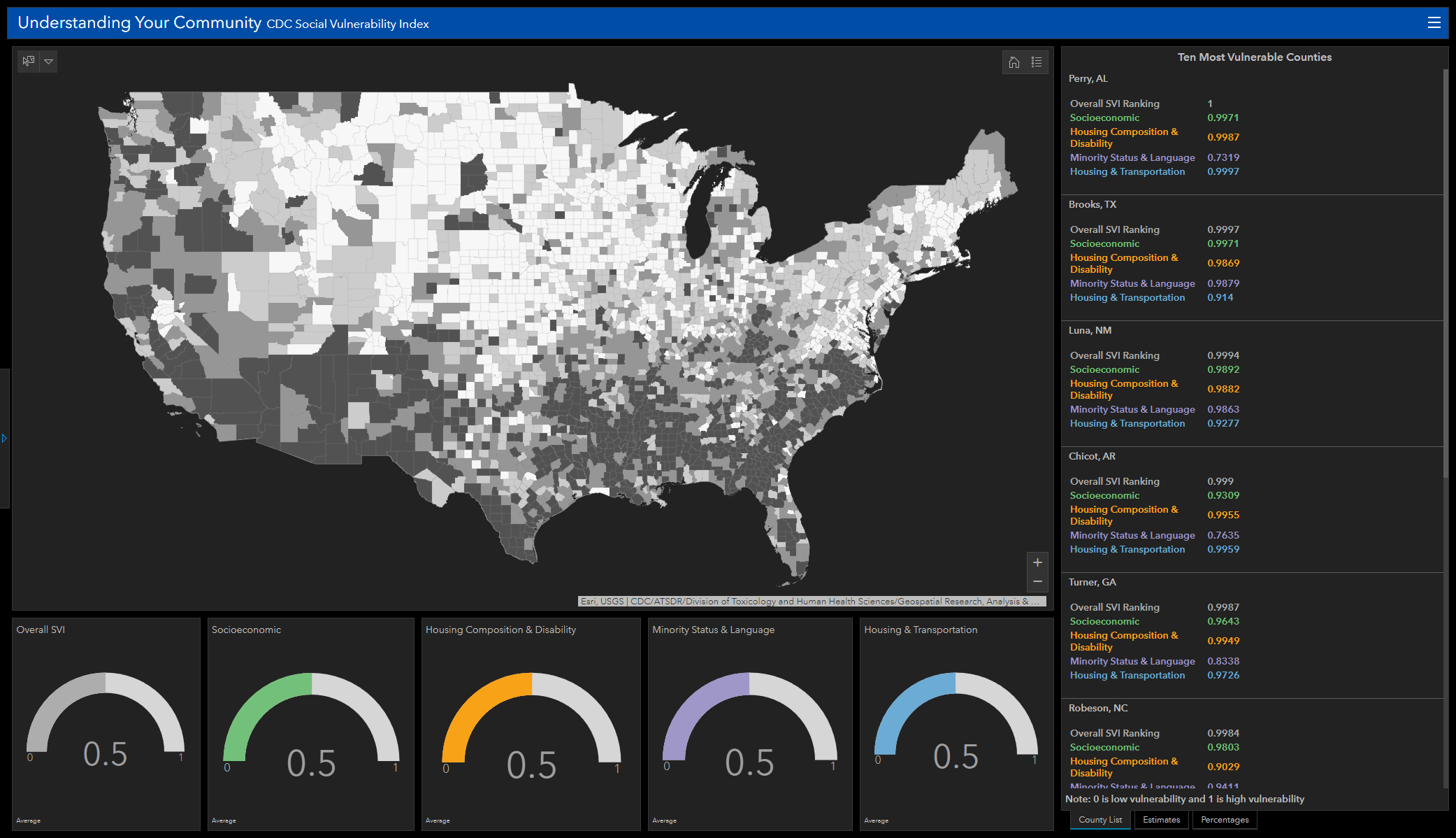
CDC Social Vulnerability Index mapping and tracking social vulnerability within the United States (Source: Esri – Analyze Racial Inequity During COVID-19).
For the Appalachian Trail Conservancy (ATC), equity maps could take a deeper look into how the distribution, ownership, access, and the perceived threat of outdoor violence play roles in the history of its recreational trail system. It could reveal the Appalachian Trail’s (A.T.) access and experience for the various demographic groups, showing how trails have affected communities of color, intersectional groups, or even the experiences of people from different backgrounds. Essentially, it could show natural areas of opportunity versus communities of high concentrations of low-income and minority residents. While honing in on the various demographic groups, equity maps could show people living close to nature and the distribution of trails to give a fair sense of the makeup of the A.T. locations. If data exists, equity maps could visualize trends over the years as a way of tracking the ATC’s equity journey.
“Equity maps could be a critical tool in helping Trailside communities identify barriers and inform actions for change to close the diversity and opportunity gaps for vulnerable populations,” said Julie Judkins, ATC Director of Education and Outreach.
Equity maps convey remarkably complex sets of information in a visual way that anyone can immediately understand. In this way, they highlight opportunities for meaningful social change. Leveraging equity maps and the results of their analyses empowers organizations and communities to create actionable plans. The actionable plans are critical because underserved or vulnerable communities often include individuals at the intersection of numerous risk factors and multiple disadvantages. These complexities make equity maps helpful for research, policy development, programming design, and are a crucial tool for communicating with the public and key stakeholders in equity advancement.
ATC’s interest in employing equity mapping could improve the outdoor recreation diversity gap, particularly for BIPOC individuals who are more likely to face these barriers in outdoor recreation. The equity maps could generate analytical and historical references, and o highlight disparities and the strengths of the A.T.’s communities. Combining these could provide nuanced interpretations of the factors that make it difficult for BIPOC individuals to use the A.T. The interpretations may aid the ATC’s programming efforts to enhance equity and participation in these groups by promoting equitable decision-making that influences how individuals of various racial identities navigate and engage in outdoor recreation.
Story mapping is a dynamic way in which equity maps can be presented. Story maps are interactive experiences that combine geographic maps with narrative text, images, and multimedia content. They are versatile tools for providing detailed information on maps and engaging with people by informing them about communities and making local or highly personal experiences more visible. Story maps can provide more nuanced accounts of some of the complex issues of inequity to geographers, activists, neighborhoods, and policymakers. Creating combined equity maps with story maps could communicate the comprehensive narratives of the A.T. communities.
The ATC is committed to fostering diversity and inclusion, and programs, such as the Emerging Leaders’ Summit, that are centered in equity work. The mapping project provided a chance for actors to be involved and spark change in their own communities.
Using GIS, you can create and sustain positive change in racial equity, social justice, and sustainable, inclusive outdoor development. Building equity maps will increase awareness of these issues and facilitate an impactful response to inequities in accessing public land.
 Oforiwaa Pee Agyei-Boakye is a Geography Ph.D. student at the University of Minnesota and works as a GIS and data analytics consultant at Gonigs Inc. She is a former ATC NextGen member, an American Trails Association Hulet Hornbeck Emerging Trails Leader, and was part of the 2017 World Trails Network Trail Visionaries Expedition Team to Tottori, Japan. Pee coordinated the equity map sessions of the 2021 ATC Emerging Leaders’ Summit with support from William Tollefson and Andrew Joyner.